jPDFFields 2021R1

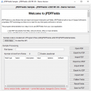
... get and set field values and can also import and export to FDF, XFDF, and XDP formats. Additionally, jPDFFields can also flatten fields in a document. Flattening is the process of merging the fields into the PDF content layer so that the information is retained but as static PDF content. ...

Author Qoppa Software, LLC
License Free To Try
Price $800.00
Released 2021-01-29
Downloads 96
Filesize 62.56 MB
Requirements Basic Windows
Installation Install and Uninstall
Keywords PDF, Java, PDF Fields
Users' rating
(20 rating)
jPDFFieldsComponents & LibrariesWin2000, Windows XP, Windows 7 x32, Windows 7 x64, Windows 8, Windows 10, WinServer, WinOther, Windows Vista, Windows Vista x64
jPDFFields data import - Download Notice

Using jPDFFields Free Download crack, warez, password, serial numbers, torrent, keygen, registration codes, key generators is illegal and your business could subject you to lawsuits and leave your operating systems without patches. We do not host any torrent files or links of jPDFFields on rapidshare.com, depositfiles.com, megaupload.com etc. All jPDFFields download links are direct jPDFFields full download from publisher site or their selected mirrors.
Avoid: data import oem software, old version, warez, serial, torrent, jPDFFields keygen, crack.
Consider: jPDFFields full version, data import full download, premium download, licensed copy.

jPDFFields data import - The Latest User Reviews

Most popular Components & Libraries downloads

CAD .NET: DWG DXF CGM PLT library for C#

12 download

... with CAD files. Its basic features include creating, importing and exporting of CAD formats (AutoCAD DWG, DXF, ... printing. A developer can get access to drawing data, the structure of which is presented in accordance ...

SmartVizor

43.0.250.718 download

... to streamline and enhance the process of variable data printing (VDP) and document management. Tailored for businesses ... precision. The software supports a wide range of data sources, allowing users to import information from databases, ...

ReqView

2.21.0 download

... tools is facilitated through ReqView's support for various import and export formats, including MS Word, Excel, and ... adaptability to different project environments. Security and data integrity are prioritized in ReqView, with features such ...

CAD Import VCL

16 download

CAD Import VCL by CADSoftTools is a robust software library ... their software projects. At its core, CAD Import VCL provides a comprehensive suite of components that facilitate the import and visualization of a wide range of CAD ...

UCC CAD Component Kit

25.01 download

... charts and diagrams. support multiple layers drawing. support import autocad's DXF file. support measure distance between a ... preview. Export with jpeg or bitmap file. Most important, it is written with 100% VC++/MFC and ships ...

Nevron Vision for .NET

2022.2 download

... is the ultimate suite for creating state-of-art powerful data presentation and map applications with spectacular visualisation capabilities. ... more. It aims to provide your applications with data visualisation capabilities, which will significantly improve the looks ...

NOV Chart for .NET

2022.1 download

... offers a large set of impressive features like data zooming, scrolling, panning and hit testing, blazing fast ... linear, logarithmic, date time, timeline axes. - Non-overlapping data and axis labels. - Resizable chart layout support ...

GdPicture.NET

14.0.33 download

... & PDF on FTP & HTTP servers. - Import / Export image from DIB, RAW, GDI+ Bitmap, HBitmap, HICON, IPicture, .NET Stream, String data, Bytes array data... - Create image from screen ...

MindFusion.Spreadsheet for WinForms

1.5 download

... to chart and image objects in worksheets and importing data from Microsoft Excel and OpenOffice Calc documents. The ... Tool-tips • Full undo/redo support • Auto fill data Programming • Programmatic access to all workbook elements ...

NOV Diagram for .NET

2022.1 download

... NOV Diagram for .NET makes it easy to import geographical data from ERSI shapefiles. You can control the way ... to be used for transforming the 3D geographical data to a 2D screen coordinates. ...