CARIS Easy View 4.2.13

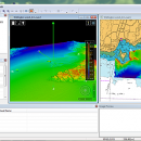
The program can render the loaded spatial data in a three-dimensional mode, allowing you to view your project from any angle. It is even possible to record videos of your fly-throughs and save them to AVI files. ...

Author CARIS
License Freeware
Price FREE
Released 2015-08-27
Downloads 145
Filesize 106.00 MB
Requirements
Installation Instal And Uninstall
Keywords View Spatial Data, View Map, Analyze Map, Map, Model, Surface, Geography
Users' rating
(7 rating)
CARIS Easy ViewCADWindows XP, Windows Vista, Windows Vista x64, Windows 7, Windows 7 x64, Windows 8, Windows 8 x64, Windows 10, Windows 10 x64
CARIS Easy View data view - Download Notice

Using CARIS Easy View Free Download crack, warez, password, serial numbers, torrent, keygen, registration codes, key generators is illegal and your business could subject you to lawsuits and leave your operating systems without patches. We do not host any torrent files or links of CARIS Easy View on rapidshare.com, depositfiles.com, megaupload.com etc. All CARIS Easy View download links are direct CARIS Easy View full download from publisher site or their selected mirrors.
Avoid: data view oem software, old version, warez, serial, torrent, CARIS Easy View keygen, crack.
Consider: CARIS Easy View full version, data view full download, premium download, licensed copy.

CARIS Easy View data view - The Latest User Reviews

Most popular CAD downloads

QGIS for Linux

3.36.1 download

... Software (FOSS). QGIS supports vector, raster, and database formats and lets you browse and create map data on your computer. QGIS supports many common spatial data formats (e.g. ESRI ShapeFile, geotiff). QGIS supports plugins ...

ShapeBook with 2D3DSteel

4.4.2009 download

... and selection tool for finding shape sizes. The data contained in this version of ShapeBook is based on the AISC Steel Construction Manual, Thirteenth Edition plus large pipe sizes, bar ...

5 award

MaxIm DL

6.05 download

... you want to produce stunning portraits, collect science data, or hunt for new objects, MaxIm DL has ... ASCOM compliant. Built-in mini-planetarium with AllSky and Zoom view helps you maintain "situational awareness": · See a ...

Panoply for Mac

5.4.3 download

... plots geo-gridded arrays from netCDF, HDF and GRIB datasets. Panoply is designed to help you view and process the data included in netCDF, HDF, GRIB, and other types of databases, in order to generate geo-gridded plots. Since the ...

Maxsurf

17.07 download

... parameters using parametric transformation · Extract key design data via lines, offsets, hydrostatic properties or curve of ... is opened in other modules. Designs in the database file are extremely compact making them ideal for ...

GEOPoint

5.1 download

... an easy to use dialog-style user interface for data entry and calculation; entry of earth station location ... and elevation contours to a KML file for viewing in Google Earth. estimation of site altitude from ...

5 award

SketchEl

1.60 download

... interactive chemical molecule sketching tool, and molecular spreadsheet data entry application. The feature set provided by the ... mouse gestures, keyboard shortcuts, utility commands and several view modes are offered in order to make this ...

2D/3D cad: dwg, dxf, plt, cgm, svg, pdf

14 download

... SVG, CGM, PLT, HPGL and other file formats. Viewing. ABViewer enables to view 2D and 3D files, measure them and convert ... formats. It is possible to create a section view of a 3D model, see its hidden elements ...

MagicPlot Pro for Mac OS X

2.9.3 download

... is a handy tool for scientific and engineer data processing, plotting and nonlinear fitting. MagicPlot Pro is ... you! Nonlinear Curve Fitting Enter equation, edit data range visually and perform a fit. MagicPlot was ...

PlotVision

8.02.1216 download

... line types, fonts etc. This means that data and information created in any CAD program can be exchanged, printed, controlled, integrated into production descriptions and marked up with redlines ...