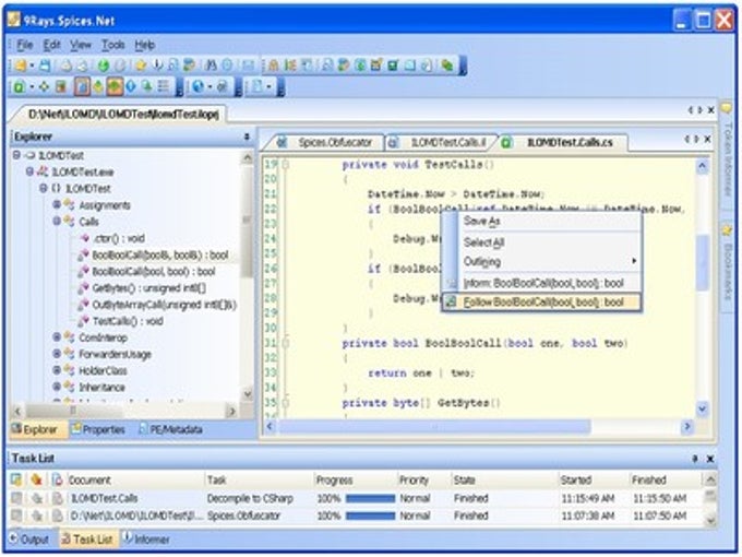
SignalLab .NET 8.0

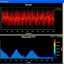
.NET for fast Digital Signal Processing(DSP) and data visualization. Allows fast complex signal manipulations with zero lines of program code. Contains SignalPlayer, SignalLogger, Signal Generators for Noise, Sine, Triangle, Square, DC and Jaehne signals, Scope, Waterfall, LowPass, HiPass, BandPass, BandStop filters, FIR, IIR, FFT, DFT, and more. Includes a visual graphical editor. Free for non-commercial use. ...

Author Mitov Software
License Free To Try
Price $579.00
Released 2020-11-26
Downloads 1097
Filesize 463.58 MB
Requirements .NET 4.0 or higher
Installation Install and Uninstall
Keywords DSP, Digital Signal Processing, Signal Processing, FFT, DFT, Goertz, Fourier, FIR, IIR, DCT, Median, Hilbert, Haar, Power Spectrum, LowPass, HiPass, BandPass, BandStop, Visual Studio, VB.NET, Library, Libraries, .NET Component, .NET Components, .NET, .NET Library
Users' rating
(23 rating)
SignalLab .NETComponents & LibrariesWindows 7 x32, Windows 7 x64, WinServer
SignalLab .NET defined - Download Notice

Using SignalLab .NET Free Download crack, warez, password, serial numbers, torrent, keygen, registration codes, key generators is illegal and your business could subject you to lawsuits and leave your operating systems without patches. We do not host any torrent files or links of SignalLab .NET on rapidshare.com, depositfiles.com, megaupload.com etc. All SignalLab .NET download links are direct SignalLab .NET full download from publisher site or their selected mirrors.
Avoid: defined oem software, old version, warez, serial, torrent, SignalLab .NET keygen, crack.
Consider: SignalLab .NET full version, defined full download, premium download, licensed copy.

SignalLab .NET defined - The Latest User Reviews

Most popular Components & Libraries downloads

GeoDLL

25.55 download

... in consideration of the continental drift - User defined Coordinate Systems, Reference Systems and earth ellipsoids - Meridian Convergence, Origin Center Meridian, Geographical Point Coordinates. GeoDLL is written in C ...

DISLIN PDF Manual

9.5 download

... ellipses and polygons. - Shielded regions can be defined. - Business graphics. - 3-D colour graphics. - 3-D graphics. - Elementary image routines. - Geographical projections and plotting of maps. ...

DISLIN for Intel Fortran

10.6 download

... ellipses and polygons. - Shielded regions can be defined. - Business graphics. - 3-D colour graphics. - 3-D graphics. - Elementary image routines. - Geographical projections and plotting of maps. ...

GeoDLL

25.55 download

... in consideration of the continental drift - User defined Coordinate Systems, Reference Systems and earth ellipsoids - Meridian Convergence, Origin Center Meridian, Geographical Point Coordinates. GeoDLL is written in C ...

Pantheios

1.0.1 Beta 218 download

... including (but not limited to) the eight levels defined by the SysLog protocol. Pantheios supports back-end output, individually and in combination, to stderr/stdout, SysLog (including a custom implementation of ...

DISLIN for LCC-Win32

10.6 download

... ellipses and polygons. - Shielded regions can be defined. - Business graphics. - 3-D colour graphics. - 3-D graphics. - Elementary image routines. - Geographical projections and plotting of maps. ...

DISLIN for Compaq Visual Fortran

10.6 download

... ellipses and polygons. - Shielded regions can be defined. - Business graphics. - 3-D colour graphics. - 3-D graphics. - Elementary image routines. - Geographical projections and plotting of maps. ...

DISGCL, DISLIN Graphics Command Language

10.6 download

... ellipses and polygons. - Shielded regions can be defined. - Business graphics. - 3-D colour graphics. - 3-D graphics. - Elementary image routines. - Geographical projections and plotting of maps. ...

DISLIN for Lahey LF90

10.6 download

... ellipses and polygons. - Shielded regions can be defined. - Business graphics. - 3-D colour graphics. - 3-D graphics. - Elementary image routines. - Geographical projections and plotting of maps. ...

DISLIN for Borland C++ 5.5/6.0

10.6 download

... ellipses and polygons. - Shielded regions can be defined. - Business graphics. - 3-D colour graphics. - 3-D graphics. - Elementary image routines. - Geographical projections and plotting of maps. ...