- Software
- - Graphic Apps
- - CAD
- - Igor Pro
Igor Pro 8.03
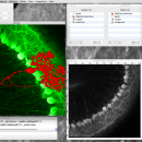
... software environment for experimentation with scientific and engineering data and for the production of publication-quality graphs and page layouts. IGOR Pro includes a powerful suite of image processing operations for image filtering, manipulation, and quantification. ...
| Author | WaveMetrics, Inc. |
| License | Trialware |
| Price | $995.00 |
| Released | 2019-06-01 |
| Downloads | 309 |
| Filesize | 251.00 MB |
| Requirements | |
| Installation | Instal And Uninstall |
| Keywords | scientific data analysis, engineering data analyzer, graph creator, engineering data, scientific data, analyzer |
| Users' rating (19 rating) |
Using Igor Pro Free Download crack, warez, password, serial numbers, torrent, keygen, registration codes,
key generators is illegal and your business could subject you to lawsuits and leave your operating systems without patches.
We do not host any torrent files or links of Igor Pro on rapidshare.com, depositfiles.com, megaupload.com etc.
All Igor Pro download links are direct Igor Pro full download from publisher site or their selected mirrors.
Avoid: external data oem software, old version, warez, serial, torrent, Igor Pro keygen, crack.
Consider: Igor Pro full version, external data full download, premium download, licensed copy.


