IPaNema 1.1.0

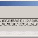
IPaNema reads any NMEA data from one of the serial ports (Com1-15) and delivers the NMEA data to any user selectable port and IP address using the UDP protocol acting as UDP server. It can also act as an UDP client, receiving NMEA sentences wrapped in UDP packets and outputs these to a serial communications port (Com1-15). ...

Author Sailsoft
License Freeware
Price FREE
Released 2012-04-02
Downloads 288
Filesize 266 kB
Requirements
Installation Instal And Uninstall
Keywords receive NMEA sentence, forward NMEA data, read GPS stream, receive, NMEA, forward
Users' rating
(18 rating)
IPaNemaCADWindows XP, Windows Vista, Windows Vista x64, Windows 7, Windows 7 x64, Windows 8, Windows 8 x64, Windows 10, Windows 10 x64
IPaNema gps - Download Notice

Using IPaNema Free Download crack, warez, password, serial numbers, torrent, keygen, registration codes, key generators is illegal and your business could subject you to lawsuits and leave your operating systems without patches. We do not host any torrent files or links of IPaNema on rapidshare.com, depositfiles.com, megaupload.com etc. All IPaNema download links are direct IPaNema full download from publisher site or their selected mirrors.
Avoid: gps oem software, old version, warez, serial, torrent, IPaNema keygen, crack.
Consider: IPaNema full version, gps full download, premium download, licensed copy.

IPaNema gps - The Latest User Reviews

Most popular CAD downloads

TNTmips

20240404 download

... reference image; place control points with coordinates from GPS devices ... Import and export an unsurpassed number of raster, geometric, and database file formats; convert between data types; and ...

TNTmips for Mac OS X

20240111 download

... reference image; place control points with coordinates from GPS devices. Import and export an unsurpassed number of raster, geometric, and database file formats; convert between data types; and link ...

Mobile Atlas Creator for Mac OS X

2.2.1 download

... source (GPL) program which creates offline atlases for GPS handhelds and cell phone applications like TrekBuddy, AndNav ... a large number of different (mobile) applications and GPS handhelds: AFTrack (Symbian) AlpineQuest (Android) AndNav (Android) BackCountry ...

QGIS

3.36.1 download

... to do things like display tracks from your GPS. QGIS aims to be an easy to use GIS, providing common functions and features. The initial goal was to provide ...

Mobile Atlas Creator

2.2.1 download

... source (GPL) program which creates offline atlases for GPS handhelds and cell phone applications like TrekBuddy, AndNav ... a large number of different (mobile) applications and GPS handhelds: AFTrack (Symbian) AlpineQuest (Android) AndNav (Android) BackCountry ...

FlashPoints

3.0 download

FlashPoints is a tool for creating and managing points Groups (topographic points for example). FlashPoints allows you to : * import/export points coordinates from and to a file * create points ...

GPS Utility

5.51 download

GPS Utility is an easy-to-use application that provides management and manipulation of GPS information. You can use it to transfer data to/from a GPS receiver and store the data in PC files ...

5 award

Engauge Digitizer for Windows

12.0 download

... but you do not have an odometer or GPS unit. However, you do have a map. Nice Features: * Automatic curve tracing of line plots * Automatic point ...

Engauge Digitizer for Mac OS X

12.0 download

... but you do not have an odometer or GPS unit. However, you do have a map. Nice Features: * Automatic curve tracing of line plots * Automatic point ...

Elshayal Smart

23.02 download

... Maps from Google Earth, and Trace & save GPS route and View and Rectify Raster Images gif, ... table structure, edit map features, drawing new features, GPS, 3D, etc... ...