TNTmips for Mac OS X 20240111

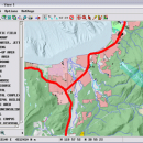
TNTmips is a geospatial image processing tool that allows you to analyze and modify GIS images. It is a professional application that can handle desktop cartography, electronic atlas preparation and spatial database management. ...

Author MicroImages, Inc.
License Freeware
Price FREE
Released 2024-01-11
Downloads 250
Filesize 87.90 MB
Requirements Mac (OS 10.8 to 11), XQuartz 2.7.9 needed (2.7.11 with manual modification)
Installation Instal And Uninstall
Keywords GIS data analysis, analyze geodetic data, edit GIS dataset, GIS, dataset, editor, analysis, mac os, TNTmips for mac, TNTgis for mac, TNTedit
Users' rating
(47 rating)
TNTmips for Mac OS XCADMac OS X
TNTmips for Mac OS X image area - Download Notice

Using TNTmips for Mac OS X Free Download crack, warez, password, serial numbers, torrent, keygen, registration codes, key generators is illegal and your business could subject you to lawsuits and leave your operating systems without patches. We do not host any torrent files or links of TNTmips for Mac OS X on rapidshare.com, depositfiles.com, megaupload.com etc. All TNTmips for Mac OS X download links are direct TNTmips for Mac OS X full download from publisher site or their selected mirrors.
Avoid: image area oem software, old version, warez, serial, torrent, TNTmips for Mac OS X keygen, crack.
Consider: TNTmips for Mac OS X full version, image area full download, premium download, licensed copy.

TNTmips for Mac OS X image area - The Latest User Reviews

Most popular CAD downloads

Easy CAD to Image Converter

3.2 download

Easy CAD to Image Converter supports conversion from DWG, DXF, DWF to ... PNG, and TGA file types. Easy CAD to Image Converter is more than a file format converter, ... render your DWG, DXF, DWF drawing files to image files of any size to answer your specific ...

Gwyddion

2.66 download

... generally used for any other height field and image analysis, for instance for analysis of profilometry data ... · statistical functions: Ra, RMS, projected and surface area, inclination, histograms, 1D and 2D correlation functions, PSDF, ...

Photogrammetric image rectification

1.0 download

... can let the program render an even wider area as spanned through this 4 points. It is also possible to erase areas in the rectified image. Simply draw over them in the program. The ...

MagicPlot Viewer for Mac OS X

2.0 download

... Plotvisor's appearance is similar to that of popular image viewers: there is the directory tree, thumbnails and preview area. Text file format and columns to be plotted ... And of course, just as with an ordinary image viewer, you can also view various image files. ...

CADbro

2020 download

... Feature Control Symbol, Surface Finish Symbol Label, Text, Image Balloon Advanced Analysis With diversified query & analysis ... features of Analysis: Mass Properties, such as volume, area, mass Draft Angle, Wall Thickness, Dynamic Section Interference ...

Gerbview x64

10.21 download

... x64 has mouse-controlled zoom in, zoom out, zoom area and panning. Features: View, print, markup ... in Gerber, HPGL/2 and Excellon files. Measure distances, areas and perimeters, with our without snapping to pads ...

DWG FastView Plus

1.0 download

... followings: Get accurate information like distance, angle and area from 2D drawings in quick and intuitive ways. ... whole or part of the Drawing to different image formats, plot DWG to PDF, share your Drawing ...

Br3D

1.3 download

... layer, line type options Save As Save As Image Saves current view as image Object snap Annotation Coordinates Distance Memo Measure Measure Area Measure Volume Multi View Single View 11 12 ...

PlanEasy2D

1.11 download

... in each floor. The dimensions of walls and area of room are shown automatically as you draw. ... jpg, pdf or one of the other common image format. Save or print the plan. ...

DataScene Deluxe

3.2.3.9 download

... graphical elements: transparent color, solid brush, gradient brush, image brush, hatch brush with 56 textures, shadow, visual aspect settings, etc. · Highly customizable and feature-rich graph axes, legend, marks, titles, ...

5 award