GEOPoint 5.1

GEOPoint can also calculate polarisation tilt angles, eirp and frequency stability, antenna G/T estimate dates and times of annual sun-outage events, and estimate path-loss and rain-attenuation based on ITU-R climate models. As used by Hausfeld Consulting for satellite communications planning. ...

Author Gunamoi Software
License Demo
Price $50.00
Released 2024-06-22
Downloads 547
Filesize 20.40 MB
Requirements
Installation Instal And Uninstall
Keywords antenna pointing calculator, geostationary communication, antenna calculator, satellite, antenna, calculate
Users' rating
(29 rating)
GEOPointCADWindows 7, Windows 7 x64, Windows 8, Windows 8 x64, Windows 10, Windows 10 x64, Windows 11
Our rating 5 award
GEOPoint image display - Download Notice

Using GEOPoint Free Download crack, warez, password, serial numbers, torrent, keygen, registration codes, key generators is illegal and your business could subject you to lawsuits and leave your operating systems without patches. We do not host any torrent files or links of GEOPoint on rapidshare.com, depositfiles.com, megaupload.com etc. All GEOPoint download links are direct GEOPoint full download from publisher site or their selected mirrors.
Avoid: image display oem software, old version, warez, serial, torrent, GEOPoint keygen, crack.
Consider: GEOPoint full version, image display full download, premium download, licensed copy.

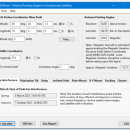
GEOPoint image display - The Latest User Reviews

Most popular CAD downloads

TinyCAD

3.00.04 download

... Web & Word Creating Circuit Diagrams for display on the Web and in Word TinyCAD ... Turn your circuit diagrams in to PNG images Although you might want to put the ...

CADopia 23 Standard

22.3.1.4100 download

... in tables and export to Excel Multileaders Raster Image insertion and editing Clipping support for references, images, and viewports Quick input Dimensioning an annotations Annotation scaling Pattern hatch Curved text Drawing tab Heads-up display toolbar Layer state manager Polar tracking Ribbon interface ...

Portable MicroDicom

2024.2 download

... application for primary processing and preservation of medical images in DICOM format. It is equipped with most common tools for manipulation of DICOM images and it has an intuitive user interface. ...

GPS Utility

5.51 download

... map and add map annotations in text or image form. GPS Utility can also be set ... to show the position on a moving map display. An interface monitor is available for diagnostic purposes ...

5 award

MicroDicom

2024.2 download

... application for primary processing and preservation of medical images in DICOM format. It is equipped with most common tools for manipulation of DICOM images and it has an intuitive user interface. ...

MicroDicom x64

2024.2 download

... application for primary processing and preservation of medical images in DICOM format. It is equipped with most common tools for manipulation of DICOM images and it has an intuitive user interface. ...

DX Central

2.20 download

... effect on radio propagation. This small application provides images of the sun and vital, timely information about ... that is concise and easy to use. Information displayed is from NASA, NIST, I Torsomo Objservatory Norway, ...

GEOPoint

5.1 download

... from a built-in list of world major cities; display of satellite azimuth and elevation contours on the ... specified satellite for common types of antenna mount; display of azimuth pointing angles relative to True North, ...

5 award

MITO

2.0 download

... makes it possible to fetch radiological information and images stored in a PACS according to the standard ... functionalities such as 2D-3D visualization (VR, SR, MIP), image segmentation and fusion, ROI. Moreover, MITO provides interaction ...

MarvinSketch

23.16.0 download

... Structure and valence checker Working with abbreviated groups Image generation, display and formatting ...