HoudahGeo for Mac OS X 6.0.2

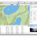
HoudahGeo works with both JPEG and RAW images. It can browse Apple Photos, iPhoto, Aperture, and ... Aperture. It also writes geotags to the original image files. Use HoudahGeo to copy location information to future-proof geotags. ...

Author Houdah Software
License Demo
Price $39.00
Released 2020-03-11
Downloads 66
Filesize 26.80 MB
Requirements
Installation Instal And Uninstall
Keywords Image geocoding, Add EXIF, Add image coordinates, Geocoding, EXIF, XMP, IPTC
Users' rating
(8 rating)
HoudahGeo for Mac OS XOtherMac OS X
HoudahGeo for Mac OS X image map - Download Notice

Using HoudahGeo for Mac OS X Free Download crack, warez, password, serial numbers, torrent, keygen, registration codes, key generators is illegal and your business could subject you to lawsuits and leave your operating systems without patches. We do not host any torrent files or links of HoudahGeo for Mac OS X on rapidshare.com, depositfiles.com, megaupload.com etc. All HoudahGeo for Mac OS X download links are direct HoudahGeo for Mac OS X full download from publisher site or their selected mirrors.
Avoid: image map oem software, old version, warez, serial, torrent, HoudahGeo for Mac OS X keygen, crack.
Consider: HoudahGeo for Mac OS X full version, image map full download, premium download, licensed copy.

HoudahGeo for Mac OS X image map - The Latest User Reviews

Most popular Other downloads

Adobe InDesign CS5

CC 2025 Build 20.4.1 download

... engaging elements such as 360° object rotation and image panoramas for a wide variety of tablets. Upload ... smoother workflow as you include refined typography and images that resize to fit virtually any screen. Even ...

AMP Tile Viewer

2.01 download

... utiliy desgned to enable you to view your images images as a mosaic, using the image like a tile texture. FEATURES: · Shows the images as a mosaic, using the loaded image as ...

Google Maps Plot Multiple Locations Software

7.0 download

... offers a solution to users who want to map multiple addresses on one Google Map. Addresses are loaded from a text file (each ... line). The result will be saved as an image file. This can be very useful, for example, ...

Batch Photo Watermark

1.0.0.0 download

... Photo Watermark allows you to add text watermarks, image watermarks, borders, and creative 'Motivational Poster' like effects to photos with ease. Easily add copyright notices, URL's, dates/times to photos before ...

ClickCharts Free Flowchart for Android

10.00 download

... diagrams with seamless sheet overlapping. *Export flowcharts as image files such as jpg, gif, png and more. ...

TatukGIS Viewer

5.87.0.3409 download

TatukGIS Viewer: A Comprehensive GIS Solution for Professionals and Enthusiasts TatukGIS Viewer, developed by TatukGIS, stands out as a robust and versatile Geographic Information System (GIS) application designed to cater ...

GeoTagNinja

Build 9300 [20250618 download

... content. The software supports a wide range of image formats, ensuring compatibility with most digital cameras and ... adjustments if necessary. The software also includes a map view, which visually represents the locations of your ...

Helicon Focus

8.3.4 download

... different focus distances into one perfectly sharp composite image, making it an indispensable asset for macro, landscape, ... The software offers multiple stacking methods—Weighted Average, Depth Map, and Pyramid—which cater to different types of images ...

Portable AMP Tile Viewer

2.01 download

... utiliy desgned to enable you to view your images images as a mosaic, using the image like a tile texture. FEATURES: · Shows the images as a mosaic, using the loaded image as ...

Panoweaver-pro-mac

7.00 download

... panorama stitching software. It supports stitching single/multiple rows images taken by normal lens, wide angle lens as ... stitching panoramas, Panoweaver can also exports 360 panoramic images into Flash VR, QuickTime VR, Java-based VR tours ...

5 award