TatukGIS Viewer 5.85.0.3356

TatukGIS Viewer is a powerful, free GIS application that allows users to visualize, analyze, and edit geospatial data with ease. Designed for both professionals and enthusiasts, it supports a wide range of formats, including vector and raster data. The intuitive interface makes navigation seamless, while advanced features like layer management, spatial analysis tools, and customizable symbology enhance user experience. Ideal for anyone needing robust GIS capabilities without the complexity, Tatu ... ...

Author TatukGIS
License Freeware
Price FREE
Released 2025-04-28
Downloads 246
Filesize 175.00 MB
Requirements
Installation Instal And Uninstall
Keywords raster image Viewer, GIS editor, GIS map, viewer, graphic, view, edit
Users' rating
(54 rating)
TatukGIS ViewerOtherWindows 11, Windows Server 2019, Windows Server 2016, Windows 10 32/64 bit, Windows Server 2012, Windows 2008 32/64 bit, Windows 2003, Windows 8 32/64 bit, Windows 7 32/64 bit, Windows Vista
TatukGIS Viewer image maps - Download Notice

Using TatukGIS Viewer Free Download crack, warez, password, serial numbers, torrent, keygen, registration codes, key generators is illegal and your business could subject you to lawsuits and leave your operating systems without patches. We do not host any torrent files or links of TatukGIS Viewer on rapidshare.com, depositfiles.com, megaupload.com etc. All TatukGIS Viewer download links are direct TatukGIS Viewer full download from publisher site or their selected mirrors.
Avoid: image maps oem software, old version, warez, serial, torrent, TatukGIS Viewer keygen, crack.
Consider: TatukGIS Viewer full version, image maps full download, premium download, licensed copy.

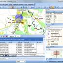
TatukGIS Viewer image maps - The Latest User Reviews

Most popular Other downloads

Stereogram Workshop

1.4.5 download

... your own pictures. FEATURES: Create Hidden Image Stereograms: · Hidden image stereograms can be made from depthmaps, using several ...

Tourweaver Standard

7.00 download

... virtual tours with 360 panoramas, flash, video, still images and floorplans. The virtual tours created by Tourweaver ... supported. 2. 360 spherical panorama, cylindrical panorama, still images, 3D object,oneshot images can be used 3. Multi-language ...

5 award

BreezeBrowser Pro

1.12.4.1 download

... digital photos or to create sophisticated web page image galleries without needing to learn HTML? Perhaps you ... without any loss of quality or work with images in their RAW format. From batch processing to ...

Terra Incognita

2.45 download

Program for downloading web source maps or local files maps for various programs or GPS devices. Requires Microsoft® ... software application built specifically for helping you view maps from various online sources, such as Google, OpenStreetMap, ...

TatukGIS Viewer

5.85.0.3356 download

... Viewer excels in its ability to render high-quality maps and spatial data visualizations. The software supports advanced ... transparency, which result in crisp and visually appealing maps. Users can customize the appearance of their maps ...

SpriteIlluminator

2.1.0 download

... its core, SpriteIlluminator allows users to create normal maps for their 2D textures. Normal maps are essential for simulating the intricate play of light and shadow on surfaces, giving flat images a three-dimensional appearance. The intuitive interface of SpriteIlluminator ...

Agisoft Metashape Professional

2.2.1 Build 20265 download

... software designed for creating high-quality 3D models and maps from photographic images. This professional-grade tool is tailored for a wide ... The software supports a comprehensive workflow, from initial image alignment to the generation of dense point clouds, ...

GeoSetter

3.5.3 download

... for of imshowing and changing geo data of image files (e.g. images taken by digital cameras).The user interface is available ... Harvey for writing data Shows existing geo coordinates, image directions and tracks on embedded Google Maps map ...

Google Maps Plot Multiple Locations Software

7.0 download

... line). The result will be saved as an image file. This can be very useful, for example, for planning deliveries to or appointments at a list of locations. ...

Stereogram Workshop for Mac OS X

1.4.3 download

... your own pictures. FEATURES: Create Hidden Image Stereograms: · Hidden image stereograms can be made from depthmaps, using several ...