Metes and Bounds 6.2.4

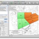
Enter measurements in rods, chains, meters, yards, inches, fathoms, hands, spans or furlongs. Angles can be given down to minutes and seconds. Can auto-close a plot drawing if the final plot segment is missing. Calculate area. Custom labels and backgrounds. Split single plots into multiple plots. GPS Waypoints and more. ...

Author Sandy Knoll Software
License Demo
Price FREE
Released 2024-12-04
Downloads 1020
Filesize 35.50 MB
Requirements
Installation Instal And Uninstall
Keywords plot map, calculate square feet, calculate acreage, calculator, acreage, perimeter
Users' rating
(43 rating)
Metes and BoundsOtherWindows 11, Windows 10 32/64 bit, Windows 8 32/64 bit, Windows 7 32/64 bit
Metes and Bounds information mapping - Download Notice

Using Metes and Bounds Free Download crack, warez, password, serial numbers, torrent, keygen, registration codes, key generators is illegal and your business could subject you to lawsuits and leave your operating systems without patches. We do not host any torrent files or links of Metes and Bounds on rapidshare.com, depositfiles.com, megaupload.com etc. All Metes and Bounds download links are direct Metes and Bounds full download from publisher site or their selected mirrors.
Avoid: information mapping oem software, old version, warez, serial, torrent, Metes and Bounds keygen, crack.
Consider: Metes and Bounds full version, information mapping full download, premium download, licensed copy.

Metes and Bounds information mapping - The Latest User Reviews

Most popular Other downloads

Metes and Bounds

6.2.4 download

... recognition. End points can also be labeled with information like the interior and exterior angles. Create ... Export real-world X,Y coordinates for integration with other mapping software such as GIS software. ยท Custom ...

Google Earth

7.3.6.10155 download

... application combines satellite imagery, aerial photography, and geographic information systems to create a comprehensive and interactive 3D ... Google Earth also integrates a wealth of information layers, offering insights into various aspects of the ...

ExpertGPS

9.19 download

... by TopoGrafix, is a robust and versatile GPS mapping software designed to cater to the needs of ... ensuring they have the most accurate and up-to-date information at their fingertips. The software supports both USGS ...

Autoshaper

1.4.3 download

... creating and manipulating vector shapes within GIS (Geographic Information System) environments. Tailored for professionals and enthusiasts alike, ... features that cater to a wide range of mapping and spatial analysis needs. At its core, ...

Google Earth for Mac OS X

7.3.6.10155 download

... a comprehensive suite of features that transcend basic mapping applications. At its core, Google Earth Pro ... a powerful tool for those working with geographical information systems. In addition to its professional capabilities, ...

TimeAlbum Pro

3.0 download

... other software and platforms. 2. **Geotagging and Mapping**: One of the standout features of TimeAlbum Pro ... other media with precise location data. The integrated mapping feature provides a visual representation of your data, ...

Album Surfer

6.0.5231 download

... detailed dive log capabilities. Users can input extensive information about each dive, including location, dive profile, gas ... exploring new dive sites, Subsurface includes a powerful mapping feature. Divers can geotag their dive locations and ...

Mindomo Desktop

11.0.6.0 download

**Mindomo Desktop: A Comprehensive Tool for Mind Mapping and Beyond** Mindomo Desktop, developed by Expert ... stands out as a versatile and robust mind mapping software designed to cater to a wide range ...

ShipPlotter

12.5.5.9 download

... This flexibility ensures that users can access real-time information about ship movements, regardless of their geographical location ... vessels in their area of interest. ShipPlotter's mapping capabilities are robust and user-friendly. The software supports ...

Graphviz

13.1.1 download

... customization options, and seamless integration capabilities. Whether you're mapping out a complex network, visualizing data relationships, or simply exploring new ways to present information, Graphviz offers the tools and flexibility to bring ...