Thuban for Linux 1.2.2

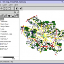
Thuban is an Interactive Geographic Data Viewer with the following features:

# Vector Data Support: Shapefile, PostGIS Layer and OGR
# Raster Data Support: GeoTIFF Layer and GDAL
# Comfortable Map Navigation
# Object Identification and Annotation
# Legend Editor and Classification
# Table Queries and Joins
# Projection Support
# Printing and Vector Export
# API for Add-Ons (Extensions) ...

Author Thuban Development Team
License Open Source
Price FREE
Released 2009-08-18
Downloads 215
Filesize 1.18 MB
Requirements
Installation Instal And Uninstall
Keywords geographic data viewer, gis viewer, analyze geographic information, information, geographic, viewer
Users' rating
(23 rating)
Thuban for LinuxCADLinux
Thuban for Linux information - Download Notice

Using Thuban for Linux Free Download crack, warez, password, serial numbers, torrent, keygen, registration codes, key generators is illegal and your business could subject you to lawsuits and leave your operating systems without patches. We do not host any torrent files or links of Thuban for Linux on rapidshare.com, depositfiles.com, megaupload.com etc. All Thuban for Linux download links are direct Thuban for Linux full download from publisher site or their selected mirrors.
Avoid: information oem software, old version, warez, serial, torrent, Thuban for Linux keygen, crack.
Consider: Thuban for Linux full version, information full download, premium download, licensed copy.

Thuban for Linux information - The Latest User Reviews

Most popular CAD downloads

SSCNC

6.84 download

... in short time. Teachers can gain current operation information of students' at any time through network teaching. The software is the first domestic NC simulation software which can be updated ...

5 award

TNTatlas for Mac OS X

2024 B20240508 download

... JP2, PNG, MrSID, DXF, and DWG. Geospatial information plays a growing part in the way we ... concern in your professional life, or such spatial information may be a growing secondary responsibility. Your duties ...

Easy CAD Viewer

3.3 download

... Review and adjust drawing properties · Obtain geometric information from drawings such as distance, length, mass, and volume · Plot DWG, DXF, DWF files to a plotter · Convert any ...

CST CAD Navigator

1 download

... of 2D and 3D CAD files. - Getting information about properties and structure of files. - Measuring of 2D drawings. - Measuring of 3D models. - Section of 3D models. ...

VeryUtils DWG to SVG Converter Command Line

2.7 download

... format SVGZ file (available upon request). * Export information of entity to SVG file. * Export the layer as [g] tag into SVG file. * Support user-defined Watermark. * Support ...

Machinist Calculator

7.11.0 download

... wire charts and so on to find the information you need. On the other hand, you can use the Machinist Calculator fast, easy and accurate and affordable. ...

TNTatlas

2024 B20240606 download

... JP2, PNG, MrSID, DXF, and DWG. Geospatial information plays a growing part in the way we ... concern in your professional life, or such spatial information may be a growing secondary responsibility. Your duties ...

TNTmips

20240404 download

TNTmips software is a complete Geographic Information System (GIS) that lets you work with virtually ... of natural terrains and mathematical surfaces from 3D information. Fast and efficient Surface Fitting, Contouring, and Triangulation ...

CST CAD Navigator for Linux

1 download

... of 2D and 3D CAD files. - Getting information about properties and structure of files. - Measuring of 2D drawings. - Measuring of 3D models. - Section of 3D models. ...

CST CAD Navigator for macOS

1 download

... of 2D and 3D CAD files. - Getting information about properties and structure of files. - Measuring of 2D drawings. - Measuring of 3D models. - Section of 3D models. ...