ArcReader 10.5.0 B6491

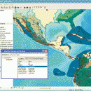
ArcReader is a free, easy-to-use desktop mapping application that allows users to view, explore, and print maps and globes. ArcReader is a free and easy-to-use application that allows users to view and print maps that are published as Published Map Files (PMF) by the ArcGIS Publisher extension to ArcView, ArcEditor, and ArcInfo. ...

Author ESRI
License Freeware
Price FREE
Released 2017-02-02
Downloads 250
Filesize 444.00 MB
Requirements
Installation Instal And Uninstall
Keywords view map, print PMF map, export bitmap, view, viewer, map, print
Users' rating
(5 rating)
ArcReaderCADWindows XP, Windows Vista, Windows Vista x64, Windows 7, Windows 7 x64, Windows 8, Windows 8 x64
ArcReader interactive tools - Download Notice

Using ArcReader Free Download crack, warez, password, serial numbers, torrent, keygen, registration codes, key generators is illegal and your business could subject you to lawsuits and leave your operating systems without patches. We do not host any torrent files or links of ArcReader on rapidshare.com, depositfiles.com, megaupload.com etc. All ArcReader download links are direct ArcReader full download from publisher site or their selected mirrors.
Avoid: interactive tools oem software, old version, warez, serial, torrent, ArcReader keygen, crack.
Consider: ArcReader full version, interactive tools full download, premium download, licensed copy.

ArcReader interactive tools - The Latest User Reviews

Most popular CAD downloads

Geneious PRO for Vista

4.7.6 download

... editor of sequences, alignments and annotations * Fully interactive, customizable plasmid maps * Navigate chromosomes and genomes ... properties * 3D protein structure viewing * Fast, interactive dot plots * Easy image export to publication ...

CADintosh

7.5.4 Build 107 download

... Workflow improvement and usability advantages * Interactive window generation (as the window is redrawn you ... for each drawing Key features: Lines and tools * 8 pens with freely definable line ...

ArcReader

10.5.0 B6491 download

... and globes. Anyone with ArcReader can view high-quality interactive maps authored by a high-level ArcGIS for Desktop ... of ArcReader. It comes with a host of tools that include a markup pen, a highlighter, a ...

Archicad

27 B3001 download

... real time to check the design, and hold interactive design sessions with clients. * Instant visualization: ArchiCAD's rendering tools are simple to use; no expert knowledge is ... derived automatically from the Virtual Building model. The interactive element schedules and Bills of Material can be ...

Gephi

0.10.1 download

... tool to traditional statistics, as visual thinking with interactive interfaces is now recognized to facilitate reasoning. This ... engine, Gephi is pushing the envelope on how interactive and efficient network exploration can be. · Networks ...

Gephi for Linux

0.10.1 download

... tool to traditional statistics, as visual thinking with interactive interfaces is now recognized to facilitate reasoning. This ... engine, Gephi is pushing the envelope on how interactive and efficient network exploration can be. · Networks ...

Gephi for Mac OS X

0.10.1 download

... tool to traditional statistics, as visual thinking with interactive interfaces is now recognized to facilitate reasoning. This ... engine, Gephi is pushing the envelope on how interactive and efficient network exploration can be. · Networks ...

CurveExpert Professional

2.7.3 download

... that you prefer, and reuse it. Graphs are interactive, with zooming, panning, autoscaling, and view stack capability. ... modify it with a suite of data transformation tools. ...

CurveExpert Professional for Linux

2.6.5 download

... that you prefer, and reuse it. Graphs are interactive, with zooming, panning, autoscaling, and view stack capability. ... modify it with a suite of data transformation tools. ...

Thuban for Linux

1.2.2 download

Thuban is an interactive geographic data viewer (GIS viewer) which features methods ... and analyze geographic information. Thuban is an Interactive Geographic Data Viewer with the following features: ... Software GIS projects. Many valuable and highly sophisticated tools exist, but there is still a need for ...