CARIS Easy View 4.2.13

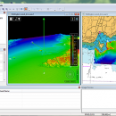
The program can render the loaded spatial data in a three-dimensional mode, allowing you to view your project from any angle. It is even possible to record videos of your fly-throughs and save them to AVI files. ...

Author CARIS
License Freeware
Price FREE
Released 2015-08-27
Downloads 148
Filesize 106.00 MB
Requirements
Installation Instal And Uninstall
Keywords View Spatial Data, View Map, Analyze Map, Map, Model, Surface, Geography
Users' rating
(9 rating)
CARIS Easy ViewCADWindows XP, Windows Vista, Windows Vista x64, Windows 7, Windows 7 x64, Windows 8, Windows 8 x64, Windows 10, Windows 10 x64
CARIS Easy View map data - Download Notice

Using CARIS Easy View Free Download crack, warez, password, serial numbers, torrent, keygen, registration codes, key generators is illegal and your business could subject you to lawsuits and leave your operating systems without patches. We do not host any torrent files or links of CARIS Easy View on rapidshare.com, depositfiles.com, megaupload.com etc. All CARIS Easy View download links are direct CARIS Easy View full download from publisher site or their selected mirrors.
Avoid: map data oem software, old version, warez, serial, torrent, CARIS Easy View keygen, crack.
Consider: CARIS Easy View full version, map data full download, premium download, licensed copy.

CARIS Easy View map data - The Latest User Reviews

Most popular CAD downloads

TNTatlas for Mac OS X

2024 B20240508 download

... you publish and distribute your maps and geospatial data — from a single geodata file to complex map layouts prepared using TNTmips. TNTatlas lets you display ... have to rapidly assemble and distribute existing electronic map and database materials for those working in natural ...

TNTmips

20240404 download

... you work with virtually any type of geospatial data including imagery, terrain surfaces, and map data with associated database attributes. It provides all the tools you need ... georeference, interpret, and publish any type of geospatial data. TNTmips provides professional geospatial tools in a single ...

TNTmips for Mac OS X

20240111 download

... you work with virtually any type of geospatial data including imagery, terrain surfaces, and map data with associated database attributes. It provides all the tools you need ... georeference, interpret, and publish any type of geospatial data. TNTmips provides professional geospatial tools in a single ...

TNTatlas

2024 B20240606 download

... you publish and distribute your maps and geospatial data — from a single geodata file to complex map layouts prepared using TNTmips. TNTatlas lets you display ... have to rapidly assemble and distribute existing electronic map and database materials for those working in natural ...

GPS Utility

5.51 download

... GPS information. You can use it to transfer data to/from a GPS receiver and store the data in PC files in one of several text formats. The program converts between different map datums and many coordinate formats (Lat/Long, UTM/UPS, country ...

5 award

SoundStepper

5.4.1.304 download

... telescope control, such as for example a sky map, autoguiding, or capture images from a webcam or ... to use the computer's sound hardware, which has data buffers and processing itself, to control step motors ...

Panoply for Mac

5.4.3 download

... plots geo-gridded arrays from netCDF, HDF and GRIB datasets. Panoply is designed to help you view and process the data included in netCDF, HDF, GRIB, and other types of databases, in order to generate geo-gridded plots. Since the ...

GEOPoint

5.1 download

... an easy to use dialog-style user interface for data entry and calculation; entry of earth station location coordinates directly, or by clicking on a world map; select earth station location from a built-in list ...

5 award

Engauge Digitizer for Windows

12.0 download

... converts an image file showing a graph or map, into numbers. The image file can come from ... with an image file containing a graph or map. The final result is digitized data that can ...

GeoMapApp

3.7.1 download

GeoMapApp is a map-based application for browsing, visualizing and analyzing a diverse suite of curated global and regional geoscience data sets. These cover geophysics, geology, geochemistry, physical oceanography, climatology, and more. GeoMapApp provides data layering, display customization and analytical tools to support ...