ediTrail 1.0

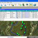
... trail/waypoint. Each trail/route can be edited over the map with vectorial CAD tools to create, move, split, join, invert trails and trackpoints, (trail vertices). ediTrail works in desktop mode and into CAD systems, (Autocad/Bricscad/Zwcad). ...

Author Aplicaciones Topográficas S.L.
License Freeware
Price FREE
Released 2014-11-07
Downloads 212
Filesize 27.05 MB
Requirements Desktop application, MIcrosoft operating systems, 32&64 bits
Installation Install and Uninstall
Keywords Trail, Route, GPS, gpx, geographical, latitude, longitude, utm, elevation, photo, Track, Way Point, Track Point, hiking, biking, cycling, map, land, terrain, surveying, DTM, D.T.M., digital terrain model, AutoCAD, BricsCAD, CAD, draw, points cloud, contouring, triangulation
Users' rating
(25 rating)
ediTrailOtherWin2000, Windows XP, Windows 7 x32, Windows 7 x64, Windows 8, WinServer, Windows Vista, Windows Vista x64
ediTrail map data - Download Notice

Using ediTrail Free Download crack, warez, password, serial numbers, torrent, keygen, registration codes, key generators is illegal and your business could subject you to lawsuits and leave your operating systems without patches. We do not host any torrent files or links of ediTrail on rapidshare.com, depositfiles.com, megaupload.com etc. All ediTrail download links are direct ediTrail full download from publisher site or their selected mirrors.
Avoid: map data oem software, old version, warez, serial, torrent, ediTrail keygen, crack.
Consider: ediTrail full version, map data full download, premium download, licensed copy.

ediTrail map data - The Latest User Reviews

Most popular Other downloads

Garmin Express

7.24.0.0 download

... update maps, install software updates, and sync your data with Garmin Connect. The intuitive interface is designed ... effort. Garmin Express also excels in its map update functionality. With regular updates available, you can ...

Metes and Bounds

6.2.4 download

... perimeter distance and more. Metes and Bounds turns data into a deed plot map. It can calculate square feet, acreage and hectares. ... distance and more. ยท Easy to use data entry form: Enter lines or curve data. ...

ExpertGPS

9.19 download

... the standout features of ExpertGPS is its extensive map library. Users have access to high-resolution aerial imagery, ... and tracks. Users can effortlessly import and export data between their GPS devices and the software, making ...

WinStars

3.0.304 (2025 download

... in stunning detail. The software boasts an extensive database, which includes over 2.5 million stars, thousands of ... that users have access to the latest astronomical data and discoveries. WinStars excels in its visual ...

WinCoot

1.1.17.2 download

... decisions during the modeling process. 2. **Density Map Visualization**: One of WinCoot's standout features is its exceptional density map visualization capabilities. The software allows users to seamlessly ... ensures that users can easily import and export data, facilitating a smooth workflow across different platforms and ...

TomTom Home

2.24.11.8 download

... area by offering easy access to the latest map updates. Users can download new maps or update ... reach their destinations efficiently. In addition to map updates, TomTom HOME offers a range of customization ...

Album Surfer

6.0.5231 download

... dive locations and view them on an integrated map, making it easy to track and revisit favorite spots. The software also supports exporting dive logs in various formats, including XML ...

MyTourbook

25.6.0 download

... compatibility with a wide range of devices and data formats. At its core, MyTourbook excels in the visualization and management of tour data. Whether you're a cyclist, runner, hiker, or skier, ...

ediTrail

1.0 download

... Export to gpx, Excel, PDF, XPS and KML/KMZ. Data table: Very flexible data table that allows sorting by columns, with inheritance of data, attributes, etc. Presentation on map: View on map ...

Panoply

5.6.1 download

... developed by Robert B. Schmunk, is a sophisticated data visualization tool designed to cater to the needs of scientists, researchers, and data enthusiasts who work extensively with multidimensional datasets. This versatile software is particularly adept at handling ...