DISGCL, DISLIN Graphics Command Language 10.6

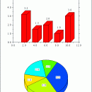
The program DISGCL is an interpreter based on the data plotting library DISLIN. DISLIN statements can be written to a script file and then be executed with DISGCL, or can be entered in an interactive mode. Similar to programming languages such as Fortran and C, high-level language elements can be used. These are variables, operators, expressions, array operations, loops, if and switch statements, user-defined functions and I/O routines. ...

Author MPI fuer Sonnensystemforschung
License Freeware
Price FREE
Released 2016-01-18
Downloads 531
Filesize 9.36 MB
Requirements Windows
Installation Install and Uninstall
Keywords scientific, plotting, programming
Users' rating
(14 rating)
DISGCL, DISLIN Graphics Command LanguageComponents & LibrariesWin2000, Windows 7 x32, Windows Vista, Windows XP
DISGCL, DISLIN Graphics Command Language map - Download Notice

Using DISGCL, DISLIN Graphics Command Language Free Download crack, warez, password, serial numbers, torrent, keygen, registration codes, key generators is illegal and your business could subject you to lawsuits and leave your operating systems without patches. We do not host any torrent files or links of DISGCL, DISLIN Graphics Command Language on rapidshare.com, depositfiles.com, megaupload.com etc. All DISGCL, DISLIN Graphics Command Language download links are direct DISGCL, DISLIN Graphics Command Language full download from publisher site or their selected mirrors.
Avoid: map oem software, old version, warez, serial, torrent, DISGCL, DISLIN Graphics Command Language keygen, crack.
Consider: DISGCL, DISLIN Graphics Command Language full version, map full download, premium download, licensed copy.

DISGCL, DISLIN Graphics Command Language map - The Latest User Reviews

Most popular Components & Libraries downloads

DISLIN for Intel Fortran

10.6 download

... scaled and labeled with linear, logarithmic, date, time, map and user-defined formats. - Plotting of curves. Several curves can appear in one axis system and can be differentiated by colour, ...

TeeChart for .NET

2024 download

It is a native c# Chart component that includes assemblies for ASP.NET, MVC, Blazor, Windows Forms, HTML5 /Javascript, WPF and Xamarin Mobile. Features include: - 60+ Chart types: from the commonly ...

NetDiagram ASP.NET Control

6.3 download

... To an image with associated client side image map · Printing and print preview · Create bitmap images Import and Export: · Export images in bmp, jpeg, gif, tiff, ...

Nevron Diagram for .NET

2022.1 download

... you create interactive and feature rich diagram and map solutions in WinForms and ASP.NET projects. The product ... full AJAX support, VS design time support, ESRI map import and provides advanced capabilities for stunning visual ...

MoSync IDE

3.2 download

... parsing · UI library and font framework · Map rendering library Extensive Mobile Platform Support: · Android Cupcake 1.5 · Java ME MIDP 2 (J2ME) · Moblin 2.x · ...

Nevron Vision for .NET

2022.2 download

... suite for creating state-of-art powerful data presentation and map applications with spectacular visualisation capabilities. Flexible and extensible, ... which works with you creating feature-rich diagram and map solutions in WinForms and WebForms. The product is ...

DISLIN for Salford FTN77/FTN90/FTN95

10.6 download

... scaled and labeled with linear, logarithmic, date, time, map and user-defined formats. - Plotting of curves. Several curves can appear in one axis system and can be differentiated by colour, ...

MoSync IDE for Mac OS X

3.2 download

... parsing · UI library and font framework · Map rendering library Extensive Mobile Platform Support: · Android Cupcake 1.5 · Java ME MIDP 2 (J2ME) · Moblin 2.x · ...

NShape

1 download

... can attach shapes to domain model objects and map properties of those model objects to visual properties like color, fill pattern etc. - NShape supports storing diagrams and models in ...

NOV Diagram for .NET

2022.1 download

... rules to them. You can also specify a map projection to be used for transforming the 3D geographical data to a 2D screen coordinates. ...