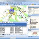
TatukGIS Viewer 5.87.0.3409

TatukGIS Viewer is a powerful, free GIS application that allows users to visualize, analyze, and edit geospatial data with ease. Designed for both professionals and enthusiasts, it supports a wide range of formats, including vector and raster data. The intuitive interface makes navigation seamless, while advanced features like layer management, spatial analysis tools, and customizable symbology enhance user experience. Ideal for anyone needing robust GIS capabilities without the complexity, Tatu ... ...

Author TatukGIS
License Freeware
Price FREE
Released 2025-07-01
Downloads 255
Filesize 187.00 MB
Requirements
Installation Instal And Uninstall
Keywords raster image Viewer, GIS editor, GIS map, viewer, graphic, view, edit
Users' rating
(57 rating)
TatukGIS ViewerOtherWindows 11, Windows Server 2019, Windows Server 2016, Windows 10 32/64 bit, Windows Server 2012, Windows 2008 32/64 bit, Windows 2003, Windows 8 32/64 bit, Windows 7 32/64 bit, Windows Vista
TatukGIS Viewer map - Download Notice

Using TatukGIS Viewer Free Download crack, warez, password, serial numbers, torrent, keygen, registration codes, key generators is illegal and your business could subject you to lawsuits and leave your operating systems without patches. We do not host any torrent files or links of TatukGIS Viewer on rapidshare.com, depositfiles.com, megaupload.com etc. All TatukGIS Viewer download links are direct TatukGIS Viewer full download from publisher site or their selected mirrors.
Avoid: map oem software, old version, warez, serial, torrent, TatukGIS Viewer keygen, crack.
Consider: TatukGIS Viewer full version, map full download, premium download, licensed copy.

TatukGIS Viewer map - The Latest User Reviews

Most popular Other downloads

AMP Tile Viewer

2.01 download

... · Kodak Photo-CD images (*.pcd) · Portable Pixel/Gray Map images (*.ppm, *.pgm, *.pbm) · Zoom in and zoom out control. · Option of showing a grid that delimitates the ...

Adobe InDesign CS5

CC 2025 Build 20.4.1 download

... typography — with no manual code changes required. Map paragraph and character styles directly to HTML, EPUB, and PDF tags so they export using appropriate specifications. Dynamic image resizing ...

ThinkComposer

1.5.150200 download

Create deep Diagrams with this Expressive Visual Tool, which Adapts to Your World! A Visual Thinking tool for Understand Complex Problems, Design Precise Solutions and Express Valuable Knowledge. Create Multilevel and ...

Helicon Focus

8.3.4 download

... The software offers multiple stacking methods—Weighted Average, Depth Map, and Pyramid—which cater to different types of images and user preferences. These algorithms ensure that the final output is not only ...

PixGPS

1.1.8 download

... or you can use whe simple 'View on map' function in PixGPS to view the location in Google Maps or MapQuest (requires an Internet connection). For many of us, ...

Google Maps Plot Multiple Locations Software

7.0 download

... offers a solution to users who want to map multiple addresses on one Google Map. Addresses are loaded from a text file (each ...

Batch Photo Watermark

1.0.0.0 download

Watermark multiple files with the single click of a button. Batch Photo Watermark allows you to add text watermarks, image watermarks, borders, and creative 'Motivational Poster' like effects to photos with ...

ClickCharts Free Flowchart for Android

10.00 download

Create flowcharts easily with this free Windows software. Whether you're mapping out ideas, laying out the structure of your organization or creating UML diagrams, ClickCharts is the perfect user-friendly program to ...

TatukGIS Viewer

5.87.0.3409 download

TatukGIS Viewer: A Comprehensive GIS Solution for Professionals and Enthusiasts TatukGIS Viewer, developed by TatukGIS, stands out as a robust and versatile Geographic Information System (GIS) application designed to cater ...

GeoTagNinja

Build 9300 [20250618 download

... adjustments if necessary. The software also includes a map view, which visually represents the locations of your photos, providing an engaging way to explore your photographic journeys. Performance-wise, GeoTagNinja ...