Cartes du Ciel 4.2.1-4073

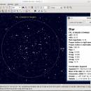
... of this program is to prepare different sky maps for a particular observation. A large number of parameters help you to choose specifically or automatically which catalogs to use, the colour and the dimension of stars and nebulae, the representation of planets, the display of labels and coordinate grids, the superposition of pictures, the condition of visibility and more. ...

Author Patrick Chevalley
License Open Source
Price FREE
Released 2024-09-30
Downloads 103
Filesize 39.70 MB
Requirements
Installation Instal And Uninstall
Keywords sky chart, sky map, sky, star, asteroid, comet
Users' rating
(12 rating)
Cartes du CielOtherWindows 11, Windows 10 32/64 bit, Windows 8 32/64 bit, Windows 7 32/64 bit
Cartes du Ciel maps - Download Notice

Using Cartes du Ciel Free Download crack, warez, password, serial numbers, torrent, keygen, registration codes, key generators is illegal and your business could subject you to lawsuits and leave your operating systems without patches. We do not host any torrent files or links of Cartes du Ciel on rapidshare.com, depositfiles.com, megaupload.com etc. All Cartes du Ciel download links are direct Cartes du Ciel full download from publisher site or their selected mirrors.
Avoid: maps oem software, old version, warez, serial, torrent, Cartes du Ciel keygen, crack.
Consider: Cartes du Ciel full version, maps full download, premium download, licensed copy.

Cartes du Ciel maps - The Latest User Reviews

Most popular Other downloads

GoogleEarthTweaker

1.08 download

If you use Google Earth to prepare for your Geocaching trips, then you'll know that it's often difficult to find the right caches and to see which ones you already visited. ...

Google Earth

7.3.6.10155 download

Google Earth, developed by Google, is a remarkable piece of software that offers users an unparalleled virtual experience of exploring our planet. This innovative application combines satellite imagery, aerial photography, and ...

Weather Watcher Live

7.3.2 download

... feature is particularly noteworthy. It provides dynamic, interactive maps that display radar, satellite imagery, and weather fronts. These maps are invaluable for visualizing weather patterns and making ... the elements. Its blend of real-time data, interactive maps, and customizable alerts makes it a standout choice ...

TomTom Home

2.24.11.8 download

... computer, ensuring that you can effortlessly manage your maps, software updates, and device settings. Keeping your maps up-to-date is crucial for accurate navigation, and TomTom ... the latest map updates. Users can download new maps or update existing ones with just a few ...

SportyPal

1.2.5 download

... have instant access to your workouts performance and maps from anywhere. The web application provides additional functionality for analysis of your fitness workouts. You can also share your exercises with ...

ExpertGPS

9.19 download

... Users have access to high-resolution aerial imagery, topographic maps, and street maps, ensuring they have the most accurate and up-to-date ... their fingertips. The software supports both USGS topo maps and seamless aerial photos, which can be invaluable ...

Metes and Bounds

6.2.4 download

... Bounds is a software that can create plot maps, perform calculations in square feets, acres, hectares, perimeter distance and more. Metes and Bounds turns data into a deed plot map. ...

Freeplane

1.12.6 download

... core, Freeplane allows users to create dynamic mind maps that can capture ideas, tasks, and complex relationships ... and hyperlinks, enabling users to build rich, interconnected maps that can be easily navigated and expanded. The ...

MyTourbook

25.6.0 download

... offers a rich array of charts, graphs, and maps that allow users to delve deep into their ... mapping functionality is particularly impressive, providing detailed route maps with customizable overlays for terrain, satellite imagery, and ...

ediTrail

1.0 download

... the active trail, which comes from providers of maps, as in 'Satellite' mode (photos, orthophotos, etc), as 'Map' mode, (Topographic map, street maps, etc). Digital Terrain Model, DTM: I have downloaded ...