Open3DQSAR 2.24

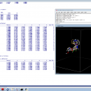
Open3DQSAR is an open-source tool aimed at pharmacophore exploration by high-throughput chemometric analysis of molecular interaction fields (MIFs). Open3DQSAR can generate steric potential, electron density and MM/QM electrostatic potential fields; furthermore, it can import GRIDKONT binary files produced by GRID and CoMFA/CoMSIA fields (exported from SYBYL with the aid of a small SPL script). ...

Author Paolo Tosco
License Open Source
Price FREE
Released 2013-06-20
Downloads 300
Filesize 1.01 MB
Requirements
Installation Instal And Uninstall
Keywords chemometric analysis, analyze MIF, pharmacophore exploration, MIF, analysis, chemometry
Users' rating
(7 rating)
Open3DQSARCADWindows XP, Windows Vista, Windows 7
Open3DQSAR maps - Download Notice

Using Open3DQSAR Free Download crack, warez, password, serial numbers, torrent, keygen, registration codes, key generators is illegal and your business could subject you to lawsuits and leave your operating systems without patches. We do not host any torrent files or links of Open3DQSAR on rapidshare.com, depositfiles.com, megaupload.com etc. All Open3DQSAR download links are direct Open3DQSAR full download from publisher site or their selected mirrors.
Avoid: maps oem software, old version, warez, serial, torrent, Open3DQSAR keygen, crack.
Consider: Open3DQSAR full version, maps full download, premium download, licensed copy.

Open3DQSAR maps - The Latest User Reviews

Most popular CAD downloads

TNTatlas for Mac OS X

2024 B20240508 download

... viewer that lets you publish and distribute your maps and geospatial data — from a single geodata ... part in the way we work and live. Maps, drawings, photos and related materials may be the ...

TNTmips

20240404 download

... formats without importing. Overlay your geodata on Bing Maps imagery and maps or on geodata layers published on the Internet ...

TNTatlas

2024 B20240606 download

... viewer that lets you publish and distribute your maps and geospatial data — from a single geodata ... part in the way we work and live. Maps, drawings, photos and related materials may be the ...

R2V

3.66 download

... R2V converts architect, mechanical and various technical drawings, maps and other types from raster to vector format. A vector format can be imported into your CAD/CAM or drawing program. R2V ...

TNTmips for Mac OS X

20240111 download

... formats without importing. Overlay your geodata on Bing Maps imagery and maps or on geodata layers published on the Internet ...

CityCAD

2.8.2 download

... early stage You can import base maps and sketch your masterplan on top of them. Once the design concept is ready, you can export your CityCAD model in ...

Mobile Atlas Creator for Mac OS X

2.2.1 download

... applications please see the features section. Additionally individual maps can be exported as one large PNG image ... can use a large number of different online maps such as OpenStreetMap, Google Maps, Yahoo Maps and ...

Panoply for Mac

5.4.3 download

... can project the analysis using more than 100 maps. What’s more, you get to overlay continent, or other types of masks on top of the generated arrays. You ...

QFitsView

8.6 download

... experience with a variety of scaling options, color maps, and region definitions, enabling precise control over how data is presented. This flexibility is crucial for identifying subtle features in astronomical ...

DataCAD

20.03.00.04 download

... control the lighting, cast shadows, and apply texture maps to create compelling, 24-bit color images of your latest design. Visualizing a project in advance allows you and your client to ...