TatukGIS Viewer 5.85.0.3356

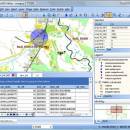
TatukGIS Viewer is a powerful, free GIS application that allows users to visualize, analyze, and edit geospatial data with ease. Designed for both professionals and enthusiasts, it supports a wide range of formats, including vector and raster data. The intuitive interface makes navigation seamless, while advanced features like layer management, spatial analysis tools, and customizable symbology enhance user experience. Ideal for anyone needing robust GIS capabilities without the complexity, Tatu ... ...

Author TatukGIS
License Freeware
Price FREE
Released 2025-04-28
Downloads 246
Filesize 175.00 MB
Requirements
Installation Instal And Uninstall
Keywords raster image Viewer, GIS editor, GIS map, viewer, graphic, view, edit
Users' rating
(54 rating)
TatukGIS ViewerOtherWindows 11, Windows Server 2019, Windows Server 2016, Windows 10 32/64 bit, Windows Server 2012, Windows 2008 32/64 bit, Windows 2003, Windows 8 32/64 bit, Windows 7 32/64 bit, Windows Vista
TatukGIS Viewer sources - Download Notice

Using TatukGIS Viewer Free Download crack, warez, password, serial numbers, torrent, keygen, registration codes, key generators is illegal and your business could subject you to lawsuits and leave your operating systems without patches. We do not host any torrent files or links of TatukGIS Viewer on rapidshare.com, depositfiles.com, megaupload.com etc. All TatukGIS Viewer download links are direct TatukGIS Viewer full download from publisher site or their selected mirrors.
Avoid: sources oem software, old version, warez, serial, torrent, TatukGIS Viewer keygen, crack.
Consider: TatukGIS Viewer full version, sources full download, premium download, licensed copy.

TatukGIS Viewer sources - The Latest User Reviews

Most popular Other downloads

Barcode Studio

17.0.1 Build 30261 download

... existing workflows. Users can import data from various sources, including Excel, CSV files, and databases, streamlining the barcode generation process. Another noteworthy aspect of Barcode Studio is its focus ...

New Version

GSA Image Analyser

4.4.1 download

The GSA Image Analyser is a program for the scientific evaluation of 2D images (image analysis). The possibilities of the program are varied and can be divided in three main groups; ...

ExifTool for Mac OS X

12.86 download

... is designed to encapsulate meta information from many sources, in binary or textual form, and bundle it together with any type of file. It can either be a single file, ...

Stereogram Workshop

1.4.5 download

... can be created using clipart from many different sources. Built-in Depthmap Creation Tool: · Grayscale depthmaps can be created using several "rubber stamp" style tools such as squares, circles, ...

Terra Incognita

2.45 download

... for helping you view maps from various online sources, such as Google, OpenStreetMap, Bing, and other similar ... map file possibility to use many web map sources Google Maps™, Bing™, Open street map ... managing ...

TatukGIS Viewer

5.85.0.3356 download

... ensuring seamless integration and compatibility with various data sources. Whether you're working with shapefiles, GeoTIFFs, or complex spatial databases, this software provides the flexibility needed to manage and analyze your ...

SpriteIlluminator

2.1.0 download

... the intensity, direction, and color of the light sources, and even simulate multiple light sources to create complex lighting scenarios. These options provide ...

New Version

MITCalc Rolling Bearings Calculation III

1.18 download

... FAG, INA, ISO, ANSI, SAE standards and other sources. Related standards: ISO 15, ISO 76, ISO 104, ISO 281, ISO 355, ISO 1132, ISO 5593, ISO 5753, ISO 3448, ISO ...

ThreeDify Excel Grapher

24.1.213 download

... file formats, ensuring seamless integration with various data sources. Users can import data directly from Excel, CSV, and other common file types, making it easy to incorporate existing datasets into ...

Stereogram Workshop for Mac OS X

1.4.3 download

... can be created using clipart from many different sources. Built-in Depthmap Creation Tool: · Grayscale depthmaps can be created using several "rubber stamp" style tools such as squares, circles, ...