VideoCAD Professional 14.0

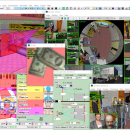
CCTV design software with 3D modeling CCTV cameras and other CCTV equipment. Physically accurate modeling of camera parameters. Professional version. VideoCAD will help you: Spare the means and win tenders due to the reduction of cameras' quantity and increase efficiency of CCTV design. Reduce time expended and boost CCTV design quality. Cut down the amount of controversial situations with customers and accelerate their solution. ...

Author CCTVCAD Software
License Demo
Price $56.00
Released 2024-11-28
Downloads 355
Filesize 270.61 MB
Requirements Core 2 processor, 1024 Mb of RAM, 1024 Mb of free hard disk space, OpenGL 3.0 support.
Installation Install and Uninstall
Keywords CCTV design software, 3D CCTV, video surveillance design, focal length calculator, scene illumination, frame rate, field of view, depth of field, IP camera, megapixel, camera resolution, camera sensitivity, IR illuminator, CCTV AutoCAD
Users' rating
(43 rating)
VideoCAD ProfessionalCADWin2000, Windows 7 x32, Windows 7 x64, Windows Vista, Windows Vista x64, Windows XP, Windows 8, Windows 10, Windows 11
VideoCAD Professional spatial - Download Notice

Using VideoCAD Professional Free Download crack, warez, password, serial numbers, torrent, keygen, registration codes, key generators is illegal and your business could subject you to lawsuits and leave your operating systems without patches. We do not host any torrent files or links of VideoCAD Professional on rapidshare.com, depositfiles.com, megaupload.com etc. All VideoCAD Professional download links are direct VideoCAD Professional full download from publisher site or their selected mirrors.
Avoid: spatial oem software, old version, warez, serial, torrent, VideoCAD Professional keygen, crack.
Consider: VideoCAD Professional full version, spatial full download, premium download, licensed copy.

VideoCAD Professional spatial - The Latest User Reviews

Most popular CAD downloads

TNTatlas for Mac OS X

2024 B20240508 download

... primary concern in your professional life, or such spatial information may be a growing secondary responsibility. Your duties may include making spatial information available to a wide audience in an ... that lets you organize, distribute, and present the spatial information in your world in an easy, atlas-like ...

VideoCAD Professional

14.0 download

... taken into account. Visualize by colors and hatch spatial resolution (pixel density) and field-of-view size of each camera on the site plan. Calculate and simulate in 3D the Depth of ...

TNTmips

20240404 download

... JPEG2000, PNG, MrSID, ECW, shapefile, File Geodatabase, Oracle Spatial, DGN, TAB, DXF, DWG ... Full-featured GIS that integrates imagery along with geometric data including vector, CAD, shape, pinmap, and ...

TNTatlas

2024 B20240606 download

... primary concern in your professional life, or such spatial information may be a growing secondary responsibility. Your duties may include making spatial information available to a wide audience in an ... that lets you organize, distribute, and present the spatial information in your world in an easy, atlas-like ...

TNTmips for Mac OS X

20240111 download

... JPEG2000, PNG, MrSID, ECW, shapefile, File Geodatabase, Oracle Spatial, DGN, TAB, DXF, DWG. Full-featured GIS that integrates imagery along with geometric data including vector, CAD, shape, pinmap, and TIN ...

MITCalc Shafts Calculation

1.24 download

... coefficients of stress concentration. - Simple definition of spatial shaft load. - Calculation of reactions, courses of forces, moments, stress, deflection and bending angle of the shaft and others. - ...

VideoCAD Starter

7.0 download

... plan. Display by separate colors different regions of spatial resolution and field-of-view size. Choose visually a relative location of cameras using the graphics window with CAD interface. Locate cameras on ...

ANTz

2019-03-18 download

... it as 'spreadsheet meets cyberspace.' An immersive multi-dimensional spatially based environment for realtime analysis and decision making. ... such as geometry, transparency, velocity and position. Spatial cues based on shape, color, size and texture ...

Amira

2019.2 download

... Vector fields · Tensors · Filament tracing · Spatial grids · Molecular visualization Analyze: · Measurement tools · Tissue statistics · Co-localization analysis · Arithmetic operations · Densitometry · ...

UCL Depthmap

0.8.0 download

... single software platform to perform a set of spatial network analyses designed to understand social processes within the built environment. It works at a variety of scales from building through ...