Panoply for Mac 5.4.3

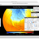
... user to plot raster image. Depending on the data, it can draw global longitude-latitude images or pole-to-pole ... plots geo-gridded arrays from netCDF, HDF and GRIB datasets. The utility can also combine two arrays and can project the analysis using more than 100 maps. ...

Author Robert B. Schmunk
License Freeware
Price FREE
Released 2024-06-24
Downloads 277
Filesize 36.40 MB
Requirements
Installation Instal And Uninstall
Keywords plot raster image, longitude image, pole-to-pole image, raster image, rasterize, raster
Users' rating
(25 rating)
Panoply for MacCADMac OS X
Panoply for Mac tables data - Download Notice

Using Panoply for Mac Free Download crack, warez, password, serial numbers, torrent, keygen, registration codes, key generators is illegal and your business could subject you to lawsuits and leave your operating systems without patches. We do not host any torrent files or links of Panoply for Mac on rapidshare.com, depositfiles.com, megaupload.com etc. All Panoply for Mac download links are direct Panoply for Mac full download from publisher site or their selected mirrors.
Avoid: tables data oem software, old version, warez, serial, torrent, Panoply for Mac keygen, crack.
Consider: Panoply for Mac full version, tables data full download, premium download, licensed copy.

Panoply for Mac tables data - The Latest User Reviews

Most popular CAD downloads

OpenAPC

2.5 download

... can be used to create motion and processing data for controlling e.g. XY-tables and connected tools for material processing. OpenAPC is as simple as possible while it offers ...

UN-SCAN-IT

7.0 download

... Software converts graph image files to usable (x,y) data automatically. UN?SCAN?IT works with most image formats (TIFF, ... digital camera, or other image source to digitize data from strip charts, instrumental output, old graphs, published ...

QGIS

3.36.1 download

... Software (FOSS). QGIS supports vector, raster, and database formats and lets you browse and create map data on your computer. QGIS supports many common spatial data formats (e.g. ESRI ShapeFile, geotiff). QGIS supports plugins ...

Panoply for Mac

5.4.3 download

... plots geo-gridded arrays from netCDF, HDF and GRIB datasets. Panoply is designed to help you view and process the data included in netCDF, HDF, GRIB, and other types of databases, in order to generate geo-gridded plots. Since the ...

GedScape

3.0.01 download

... software utility for browsing, manipulating, converting and extracting data from GEDCOM files. It is the ideal GEDCOM ... tool for genealogists. Features: Easily browse all data for individuals and families within GEDCOM files, including ...

tinyFLP

1.30 download

... for automatic peak selection and scoring of AFLP data tables witten by Wolfgang Arthofer, University of Innsbruck. Austria. ...

GedScape for MAC OS X

3.0.01 download

... software utility for browsing, manipulating, converting and extracting data from GEDCOM files. It is the ideal GEDCOM ... tool for genealogists. Features: Easily browse all data for individuals and families within GEDCOM files, including ...

PipeDrop

1.2.6 download

... and Lockhart-Martinelli methods. * Instant access to pipe tables (both ANSI/ASME and ISO/DIN standards). * Instant access ... physical properties (seamless integration with PhysProps). * Instant data sheet print-out of calculation results. Pump Network ...

GraphPad Prism

10.4.2.633 download

... a premier tool tailored for scientific research and data analysis. This versatile software seamlessly integrates scientific graphing, ... it an indispensable asset for researchers, biologists, and data analysts. One of the hallmarks of GraphPad ...

GOM Inspect

7.5 SR1 download

... and viewer for ATOS and GOM Inspect Professional data sets. Features from GOM Inspect include CAD Data and 3D Point Cloud Import 3D Mesh Processing 3D Inspection Tools 2D Analysis Comprehensive Reporting Data Export Extensive, certified inspection tools GOM ...