MyTourbook 25.6.0

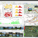
MyTourbook, developed by Wolfgang Schramm, is a powerful open-source software designed for outdoor enthusiasts and fitness aficionados. It enables users to analyze and visualize their tour data, offering comprehensive features like route planning, performance tracking, and detailed statistics. With support for various GPS devices and formats, MyTourbook caters to cyclists, hikers, and runners alike. Its intuitive interface and customizable options make it an essential tool for anyone looking to ... ...

Author Wolfgang Schramm
License Open Source
Price FREE
Released 2025-06-19
Downloads 284
Filesize 153.00 MB
Requirements
Installation Instal And Uninstall
Keywords Analyze Tour, Tour, Map, Route, Analyze
Users' rating
(23 rating)
MyTourbookOtherWindows 11, Windows 10 64 bit, Windows 8 64 bit, Windows 7 64 bit
MyTourbook time map - Download Notice

Using MyTourbook Free Download crack, warez, password, serial numbers, torrent, keygen, registration codes, key generators is illegal and your business could subject you to lawsuits and leave your operating systems without patches. We do not host any torrent files or links of MyTourbook on rapidshare.com, depositfiles.com, megaupload.com etc. All MyTourbook download links are direct MyTourbook full download from publisher site or their selected mirrors.
Avoid: time map oem software, old version, warez, serial, torrent, MyTourbook keygen, crack.
Consider: MyTourbook full version, time map full download, premium download, licensed copy.

MyTourbook time map - The Latest User Reviews

Most popular Other downloads

Mindomo Desktop

11.0.6.0 download

**Mindomo Desktop: A Comprehensive Tool for Mind Mapping and Beyond** Mindomo Desktop, developed by Expert Software Applications, stands out as a versatile and robust mind mapping software designed to cater ...

WriteMapper

4.4.3 download

... brainstorm and outline their ideas in a mind map format, which can then be expanded into detailed ... quickly create and manipulate nodes on the mind map. Each node represents a section or paragraph of ...

RouteConverter

3.1.386 download

... features of RouteConverter is its intuitive and interactive map interface. Users can easily drag and drop waypoints, ... popular mapping services. This real-time interaction with the map provides a clear and immediate understanding of the ...

Google Earth for Mac OS X

7.3.6.10155 download

... feature, for instance, lets users travel back in time to view how certain locations have evolved over the years. This is not only fascinating from a historical perspective but also ...

Google Earth images downloader

6.440 download

... entering coordinates or selecting a region on the map. The tool then downloads the images within the ... offers batch downloading capabilities, which is a significant time-saver for users who need to acquire large datasets. ...

MapTiler Engine

14.0.2 download

... who need to transform geospatial data into high-quality map tiles. This powerful tool excels in converting raster ... user-friendly interface, which simplifies the complex process of map tiling. Users can effortlessly upload their geospatial data, ...

WinStars

3.0.304 (2025 download

... from any location on Earth at any given time. This means users can observe celestial events as they happen or travel back in time to witness historical astronomical phenomena. The software also ...

Drafter

4.10 download

... data from a spreadsheet or exporting a mind map to a presentation, Drafter handles these tasks with ease. Performance-wise, Drafter is lightweight and responsive, ensuring a smooth user experience ...

5 award

Tray Weather

1.34.1 download

**Tray Weather: A Minimalist Weather Companion for Your Desktop** Tray Weather, developed by Félix de las Pozas Álvarez, is a sleek and efficient weather application designed to provide real-time weather ...

MyTourbook

25.6.0 download

... help users understand their performance and progress over time. The mapping functionality is particularly impressive, providing detailed route maps with customizable overlays for terrain, satellite imagery, and more. In ...