TatukGIS Viewer 5.85.0.3356

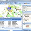
TatukGIS Viewer is a powerful, free GIS application that allows users to visualize, analyze, and edit geospatial data with ease. Designed for both professionals and enthusiasts, it supports a wide range of formats, including vector and raster data. The intuitive interface makes navigation seamless, while advanced features like layer management, spatial analysis tools, and customizable symbology enhance user experience. Ideal for anyone needing robust GIS capabilities without the complexity, Tatu ... ...

Author TatukGIS
License Freeware
Price FREE
Released 2025-04-28
Downloads 246
Filesize 175.00 MB
Requirements
Installation Instal And Uninstall
Keywords raster image Viewer, GIS editor, GIS map, viewer, graphic, view, edit
Users' rating
(54 rating)
TatukGIS ViewerOtherWindows 11, Windows Server 2019, Windows Server 2016, Windows 10 32/64 bit, Windows Server 2012, Windows 2008 32/64 bit, Windows 2003, Windows 8 32/64 bit, Windows 7 32/64 bit, Windows Vista
TatukGIS Viewer web services - Download Notice

Using TatukGIS Viewer Free Download crack, warez, password, serial numbers, torrent, keygen, registration codes, key generators is illegal and your business could subject you to lawsuits and leave your operating systems without patches. We do not host any torrent files or links of TatukGIS Viewer on rapidshare.com, depositfiles.com, megaupload.com etc. All TatukGIS Viewer download links are direct TatukGIS Viewer full download from publisher site or their selected mirrors.
Avoid: web services oem software, old version, warez, serial, torrent, TatukGIS Viewer keygen, crack.
Consider: TatukGIS Viewer full version, web services full download, premium download, licensed copy.

TatukGIS Viewer web services - The Latest User Reviews

Most popular Other downloads

PDF Writer for Windows Server 2012

1.01 download

... and ICC profile integrated with PDF files; Convert web pages into PDF; Restrict viewing, printing, editing, or ... sRGB, CMYK Color Space support; Live hyperlinks; Fast Web view; Custom paper size; Page orientation; Resolution up ...

Cacidi LiveMerge

CC 2015 download

... similar productions, without the necessity for external consultancy services. Custom data feed The feature Custom data ... a script, which by a XMLHttpRequest (part of Web 2.0 and AJAX), extracts data from all kinds ...

uDig

2.0.0 download

... WCS) and de facto (GeoRSS, KML, tiles) geospatial web services; and, GIS ready, providing the framework on ...

ShareX Portable

17.0.0 download

... capture, which is particularly useful for capturing lengthy web pages or documents. One of the standout ... The software supports a wide array of cloud services, enabling users to upload and share files effortlessly. ...

Terra Incognita

2.45 download

Program for downloading web source maps or local files maps for various ... such as Google, OpenStreetMap, Bing, and other similar services. Terra Incognita™ main features: navigating through ... TrekBuddy calibrated map file possibility to use many web map sources Google Maps™, Bing™, Open street map ...

Batch MMedia Date Changer

1.90 download

... EXIF Date is important when uploading to the web especially one of the many cloud based photo storage services. It even comes with its own Filename Changer ...

TatukGIS Viewer

5.85.0.3356 download

... colleagues and stakeholders. Additionally, the software's compatibility with web mapping services (WMS) and web feature services (WFS) allows for seamless integration with online GIS ...

Photo Editing & Saving Wizard

2021 download

... easy to use photo hosting and photo sharing services. Photo Editing & Saving Wizard works as a ... integration allows you to save photos in the Web. Our photo hosting service allows you to upload ...

5 award

Shozam Express Edition

1.5.4.0 download

... people who want to go beyond just a web photo album. Have photos and video clips sitting on your PC or scattered across web services sites? Bring them together and showcase them ...

uDig x64

1.4.0 download

... WCS) and de facto (GeoRSS, KML, tiles) geospatial web services; and, GIS ready, providing the framework on ...