- Software
- - Home & Hobby
- - Other
- - Virtual GPS
Virtual GPS 1.59
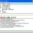
Virtual GPS by Zyl Soft is a versatile software solution that simulates GPS data for various applications, making it ideal for developers and testers. With its user-friendly interface, users can easily create and manage virtual GPS locations, allowing for seamless testing of location-based services without the need for physical movement. The software supports multiple formats and integrates smoothly with various applications, enhancing productivity and efficiency. Perfect for anyone needing reli ... ...
| Author | Zyl Soft |
| License | Trialware |
| Price | FREE |
| Released | 2025-03-02 |
| Downloads | 1015 |
| Filesize | 3.30 MB |
| Requirements | |
| Installation | |
| Keywords | Virtual GPS, GPS simulator, GPS receiver, GPS, simulator, satellite, simulate |
| Users' rating (14 rating) |
Using Virtual GPS Free Download crack, warez, password, serial numbers, torrent, keygen, registration codes,
key generators is illegal and your business could subject you to lawsuits and leave your operating systems without patches.
We do not host any torrent files or links of Virtual GPS on rapidshare.com, depositfiles.com, megaupload.com etc.
All Virtual GPS download links are direct Virtual GPS full download from publisher site or their selected mirrors.
Avoid: world latitude longitude oem software, old version, warez, serial, torrent, Virtual GPS keygen, crack.
Consider: Virtual GPS full version, world latitude longitude full download, premium download, licensed copy.


