PAST for Mac OS X 4.03

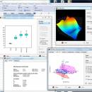
Past is free software for scientific data analysis, with functions for data manipulation, plotting, univariate and multivariate statistics, ecological analysis, time series and spatial analysis, morphometrics and stratigraphy. Past packs together numerous data manipulation techniques that prove to be very useful when analyzing scientific data. ...

Author Oyvind Hammer
License Freeware
Price FREE
Released 2020-06-02
Downloads 169
Filesize 9.90 MB
Requirements Mac OSX Catalina, Mojave, High Sierra, Sierra
Installation Instal And Uninstall
Keywords data analysis, scatter, paleontology, analyze, 3D scatter, statistical function, analysis
Users' rating
(15 rating)
PAST for Mac OS XCADMac OS X
PAST for Mac OS X analysis - Download Notice

Using PAST for Mac OS X Free Download crack, warez, password, serial numbers, torrent, keygen, registration codes, key generators is illegal and your business could subject you to lawsuits and leave your operating systems without patches. We do not host any torrent files or links of PAST for Mac OS X on rapidshare.com, depositfiles.com, megaupload.com etc. All PAST for Mac OS X download links are direct PAST for Mac OS X full download from publisher site or their selected mirrors.
Avoid: analysis oem software, old version, warez, serial, torrent, PAST for Mac OS X keygen, crack.
Consider: PAST for Mac OS X full version, analysis full download, premium download, licensed copy.

PAST for Mac OS X analysis - The Latest User Reviews

Most popular CAD downloads

TNTmips

20240404 download

TNTmips software is a complete Geographic Information System (GIS) that lets you work with virtually any type of geospatial data including imagery, terrain surfaces, and map data with associated database attributes. ...

TNTmips for Mac OS X

20240111 download

TNTmips for Mac is a complete Geographic Information System (GIS) that lets you work with virtually any type of geospatial data including imagery, terrain surfaces, and map data with associated database ...

CADbro

2020 download

... Surface Finish Symbol Label, Text, Image Balloon Advanced Analysis With diversified query & analysis tools in CADbro, you can verify the manufacturability ... cost and save the time. Key features of Analysis: Mass Properties, such as volume, area, mass Draft ...

Oasys AdSec

8.4 Build 41 download

AdSec’s analysis helps design all kinds of sections under load. ... For uniaxial and biaxial conditions, the software gives analysis options for serviceability and ultimate limit states to ... engineers around the world, AdSec is the leading analysis program for sections under load. ...

Digimizer

6.4.0 download

Digimizer is an easy-to-use and flexible image analysis software package that allows precise manual measurements as ... mile (mi), degrees (°) or pixels Image analysis Binarization Options: overlay binary image, hide binary ...

jHepWork

31.1 download

... is an interactive environment for scientific computation, data analysis and data visualization designed for scientists, engineers and ... The program can be used everywhere where an analysis of large numerical data volumes, data mining, statistical ...

5 award

Gephi for Linux

0.10.1 download

... reasoning. This is a software for Exploratory Data Analysis, a paradigm appeared in the Visual Analytics field ... offer the most common metrics for social network analysis (SNA) and scale-free networks. · Betweenness, Closeness, Diameter, ...

Gephi for Mac OS X

0.10.1 download

... reasoning. This is a software for Exploratory Data Analysis, a paradigm appeared in the Visual Analytics field ... offer the most common metrics for social network analysis (SNA) and scale-free networks. · Betweenness, Closeness, Diameter, ...

Panoply for Mac

5.4.3 download

... also combine two arrays and can project the analysis using more than 100 maps. What’s more, you get to overlay continent, or other types of masks on top of the ...

GPS Utility

5.51 download

... and can be transferred into other programs for analysis (i.e. spreadsheet programs). By using a scanned or digital bitmap you can digitize waypoints, routes and tracks. You can plot ...

5 award