Panoply for Mac 5.4.3

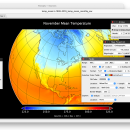
Panoply for Mac is an utility that enable user to plot raster image. Depending on the data, it can draw global longitude-latitude images or pole-to-pole latitude-vertical images.Panoply is a cross-platform application which plots geo-gridded arrays from netCDF, HDF and GRIB datasets. The utility can also combine two arrays and can project the analysis using more than 100 maps. ...

Author Robert B. Schmunk
License Freeware
Price FREE
Released 2024-06-24
Downloads 249
Filesize 36.40 MB
Requirements
Installation Instal And Uninstall
Keywords plot raster image, longitude image, pole-to-pole image, raster image, rasterize, raster
Users' rating
(24 rating)
Panoply for MacCADMac OS X
Panoply for Mac browse files - Download Notice

Using Panoply for Mac Free Download crack, warez, password, serial numbers, torrent, keygen, registration codes, key generators is illegal and your business could subject you to lawsuits and leave your operating systems without patches. We do not host any torrent files or links of Panoply for Mac on rapidshare.com, depositfiles.com, megaupload.com etc. All Panoply for Mac download links are direct Panoply for Mac full download from publisher site or their selected mirrors.
Avoid: browse files oem software, old version, warez, serial, torrent, Panoply for Mac keygen, crack.
Consider: Panoply for Mac full version, browse files full download, premium download, licensed copy.

Panoply for Mac browse files - The Latest User Reviews

Most popular CAD downloads

Gephi

0.10.1 download

... in workspaces and save their session .gephi project files. · Save/Load project files · Use the Data Table view to browse and edit data Modular: · Gephi 0.7 ...

Gephi for Linux

0.10.1 download

... in workspaces and save their session .gephi project files. · Save/Load project files · Use the Data Table view to browse and edit data Modular: · Gephi 0.7 ...

Gephi for Mac OS X

0.10.1 download

... in workspaces and save their session .gephi project files. · Save/Load project files · Use the Data Table view to browse and edit data Modular: · Gephi 0.7 ...

SDMetrics

2.5 download

... SDMetrics with reverse engineering tools that produce XMI files from C++, Java, Delphi, or Smalltalk source code, ... you can interactively explore measurement data, identify outliers, browse histograms and Kiviat charts. Command line interface: ...

QGIS

3.36.1 download

... vector, raster, and database formats and lets you browse and create map data on your computer. ... formats support by the OGR library · MapInfo files · GRASS integration, including view, edit, and analysis ...

QGIS for Mac

3.36.1 download

... vector, raster, and database formats and lets you browse and create map data on your computer. ... formats support by the OGR library · MapInfo files · GRASS integration, including view, edit, and analysis ...

QGIS for Linux

3.36.1 download

... vector, raster, and database formats and lets you browse and create map data on your computer. ... formats support by the OGR library · MapInfo files · GRASS integration, including view, edit, and analysis ...

Panoply for Mac

5.4.3 download

... is organized into multiple tabs that help you browse between datasets and catalogues, to adjust the scale ... bitmap images or as PDF or PostScript graphics files. Export lon-lat map plots in KMZ format. Export ...

Simstat

2.6 download

... spreadsheet formats as well as ASCII and SPSS files. Data Management The data window is ... like data editor where values can be entered, browsed, or edited. It has the following features: - ...

Online CAD Converter

1.5 download

... safest solution to convert CAD, CGM, HPGL, SVG files. Output file types include PDF, TIFF, JPEG, EMF, ... Online CAD Converter is fast and user-friendly. You browse for your CAD file and then wait for ...