Eye4Software Hydromagic 7.0.15.929

... The software can be used with various map formats including: GeoTIFF, Microstation DGN, ARC/INFO, MapInfo MIF/MID, AutoCad DXF files, IHO S57/S63 Electronic Natutical Charts and ESRI shapefiles. ...

Author Eye4Software B.V.
License Demo
Price $1549.93
Released 2015-10-09
Downloads 588
Filesize 83.02 MB
Requirements Windows XP SP3 or higher
Installation Install and Uninstall
Keywords Hydrographic Survey Software, Hydrographic Software, Hydrographic Survey, Bathymetry, Seafloor Mapping Software, Hydrographic Data Acquisition, Dredging Volume Calculation, Volume Calculations, Bathymetric Software, Single Beam Data Collection
Users' rating
(23 rating)
Eye4Software HydromagicMath & Scientific ToolsWin2000, Windows XP, Windows 7 x32, Windows 7 x64, Windows 8, Windows 10, WinServer, WinOther, Windows Vista, Windows Vista x64
Eye4Software Hydromagic data formats - Download Notice

Using Eye4Software Hydromagic Free Download crack, warez, password, serial numbers, torrent, keygen, registration codes, key generators is illegal and your business could subject you to lawsuits and leave your operating systems without patches. We do not host any torrent files or links of Eye4Software Hydromagic on rapidshare.com, depositfiles.com, megaupload.com etc. All Eye4Software Hydromagic download links are direct Eye4Software Hydromagic full download from publisher site or their selected mirrors.
Avoid: data formats oem software, old version, warez, serial, torrent, Eye4Software Hydromagic keygen, crack.
Consider: Eye4Software Hydromagic full version, data formats full download, premium download, licensed copy.

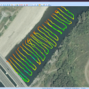
Eye4Software Hydromagic data formats - The Latest User Reviews

Most popular Math & Scientific Tools downloads

OkMap Desktop

18.10.3 download

... paths by creating waypoints, routes and tracks -Uploads/downloads data to/from your GPS -Uses altitude DEM data -Supports GPS real-time navigation -Sends/receives vehicles position and ... to store and display elevation -Upload / download data to / from GPS devices -Navigate in real ...

XLRISK

6.1.3.3 download

... displayed in a variety of graphical and statistical formats that will tell you things like: - What ... time series functions. - Fitting: Fitting distributions to data (95), fitting correlations structures to data (11), fitting ...

ZENPLOT

1.1.0.163 download

ZENPLOT, the data visualization software dedicated to advanced graphics ZENPLOT allows ... area chart, labels, annotations, axis, legend etc.). The data can be linked to any characteristic of the ... learning. Your visualizations can be exported in different formats (.PNG, .SVG, et cetera) so that you can ...

DigitizeIt for Mac

2.5.9 download

... can be loaded in nearly all common image formats (incl. gif,tiff,jpeg,bmp,png,psd,pcx,xbm,xpm,tga,pct) or pasted from the clipboard . ... manual digitizing via mouse clicks is also possible. Data values are transformed to a specified axes system ...

SO-Shear

1.1.7151.1 download

... and samples) and tests. In addition to test data and corresponding calculations, software outputs are available in 12 formats. Note that direct shear tests could randomly be ... for the export of software outputs. - Test data and corresponding calculations are presented in a separate ...

Eye4Software Hydromagic

7.0.15.929 download

... writing most popular CAD, GIS and nautical chart formats, including: GeoTIFF, Microstation DGN, ARC/INFO, MapInfo MIF/MID, AutoCad ... used to collect and process dual frequency sounding data, as well as additional sensor data, such as ...

SO-Sieve

1.1.7151.1 download

... outputs are exported in both landscape and portrait formats. - Test data and corresponding calculations are presented in a separate format. - Blank laboratory data sheets may be used for test data input. ...

StatPlus

6.2.2.0 download

... no knowledge of statistics are capable of processing data, provided they know how to use PC and ... than agonizing over who and how processed the data, and if any mistakes were made in the ...