Total CAD Converter 1.8

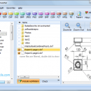
CAD Converter will help you to convert CAD files to tiff, PDF, bmp, jpeg, png, wmf, dxf. Source formats are dwg, dxf, plt, hgl, hg, hpg, plo, ... cgm, svg. CAD Converter will also resize your files or combine them into one final document. All ... batch! You may add watermarks to the output files. Handle CAD converter via GUI or command line. Download your free full-optional version and try it out. ...

Author Softplicity
License Free To Try
Price $99.90
Released 2013-08-08
Downloads 741
Filesize 13.29 MB
Requirements A standart windows PC
Installation Install and Uninstall
Keywords converter, dwg, PDF, dxf, plt, hgl, hpg, plo, hp1, hp2, hpgl, hpgl2, gl2, prn, spl, cgm, svg, tiff, bmp, jpeg, png, wmf, dxf, software
Users' rating
(20 rating)
Total CAD ConverterCADWindows XP, Windows Vista, Windows Vista x64, Windows 7 x32, Windows 7 x64, Win2000, WinOther, Windows 2000, Windows 2003, WinServer, Windows Vista, Windows Vista x64, WinMobile, Windows Vista, Wi
Total CAD Converter digital file formats - Download Notice

Using Total CAD Converter Free Download crack, warez, password, serial numbers, torrent, keygen, registration codes, key generators is illegal and your business could subject you to lawsuits and leave your operating systems without patches. We do not host any torrent files or links of Total CAD Converter on rapidshare.com, depositfiles.com, megaupload.com etc. All Total CAD Converter download links are direct Total CAD Converter full download from publisher site or their selected mirrors.
Avoid: digital file formats oem software, old version, warez, serial, torrent, Total CAD Converter keygen, crack.
Consider: Total CAD Converter full version, digital file formats full download, premium download, licensed copy.

Total CAD Converter digital file formats - The Latest User Reviews

Most popular CAD downloads

TNTmips for Mac OS X

20240111 download

... Include layers in a wide variety of external formats without importing. Overlay your geodata on Bing Maps ... an unsurpassed number of raster, geometric, and database file formats; convert between data types; and link to ...

GPS Utility

5.51 download

... GPS receiver and store the data in PC files in one of several text formats. The program converts between different map datums and many coordinate formats (Lat/Long, UTM/UPS, country grids etc.). Information can be ...

5 award

Engauge Digitizer for Mac OS X

12.0 download

... This open source, digitizing software converts an image file showing a graph or map, into numbers. The image file can come from a scanner, digital camera or screenshot. The numbers can be read ...

TopoLT

15.2 download

... those who design topographical or cadastral plans in digital format, who develop 3D terrain models and contours, ... necessary to create topographical and cadastral plans in digital format. With a tradition of over 25 ...

QGIS

3.36.1 download

... (FOSS). QGIS supports vector, raster, and database formats and lets you browse and create map data ... computer. QGIS supports many common spatial data formats (e.g. ESRI ShapeFile, geotiff). QGIS supports plugins to ...

QGIS for Linux

3.36.1 download

... (FOSS). QGIS supports vector, raster, and database formats and lets you browse and create map data ... computer. QGIS supports many common spatial data formats (e.g. ESRI ShapeFile, geotiff). QGIS supports plugins to ...

Total CAD Converter

1.8 download

CAD Converter will help you to convert CAD files to tiff, pdf, bmp, jpeg, png, wmf, dxf. Source formats are dwg, dxf, plt, hgl, hg, hpg, plo, ... svg. The latest version supports Autodesk AutoCAD 2013 files. Total CAD Converter will also resize your files ...

Engauge Digitizer for Windows

12.0 download

... This open source, digitizing software converts an image file showing a graph or map, into numbers. The image file can come from a scanner, digital camera or screenshot. The numbers can be read ...

Engauge Digitizer for Linux

12.0 download

... This open source, digitizing software converts an image file showing a graph or map, into numbers. The image file can come from a scanner, digital camera or screenshot. The numbers can be read ...

TNTmips

20240404 download

... Include layers in a wide variety of external formats without importing. Overlay your geodata on Bing Maps ... an unsurpassed number of raster, geometric, and database file formats; convert between data types; and link to ...