ArcReader 10.5.0 B6491

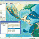
ArcReader is a free, easy-to-use desktop mapping application that allows users to view, explore, and print maps and globes. ArcReader is a free and easy-to-use application that allows users to view and print maps that are published as Published Map Files (PMF) by the ArcGIS Publisher extension to ArcView, ArcEditor, and ArcInfo. ...

Author ESRI
License Freeware
Price FREE
Released 2017-02-02
Downloads 232
Filesize 444.00 MB
Requirements
Installation Instal And Uninstall
Keywords view map, print PMF map, export bitmap, view, viewer, map, print
Users' rating
(3 rating)
ArcReaderCADWindows XP, Windows Vista, Windows Vista x64, Windows 7, Windows 7 x64, Windows 8, Windows 8 x64
ArcReader gis data - Download Notice

Using ArcReader Free Download crack, warez, password, serial numbers, torrent, keygen, registration codes, key generators is illegal and your business could subject you to lawsuits and leave your operating systems without patches. We do not host any torrent files or links of ArcReader on rapidshare.com, depositfiles.com, megaupload.com etc. All ArcReader download links are direct ArcReader full download from publisher site or their selected mirrors.
Avoid: gis data oem software, old version, warez, serial, torrent, ArcReader keygen, crack.
Consider: ArcReader full version, gis data full download, premium download, licensed copy.

ArcReader gis data - The Latest User Reviews

Most popular CAD downloads

QGIS for Mac

3.36.1 download

QGIS is a professional GIS application that is built on top of and ... Software (FOSS). QGIS supports vector, raster, and database formats and lets you browse and create map data on your computer. QGIS supports many common ...

QGIS for Linux

3.36.1 download

QGIS is a professional GIS application that is built on top of and ... Software (FOSS). QGIS supports vector, raster, and database formats and lets you browse and create map data on your computer. QGIS supports many common ...

Metes and Bounds

6.2.1 download

... perimeter distance and more. Metes and Bounds turns data into a deed plot map. It can calculate ... distance and more. · Easy to use data entry form: Enter lines or curve data. ...

JMARS

3.1.5 download

... Space Flight Facility to provide mission planning and data-analysis tools to NASA's orbiters, instrument team members, students ... to more than a terabyte of NASA orbiter data, and has basic image and vector processing features ...

TNTmips

20240404 download

... you work with virtually any type of geospatial data including imagery, terrain surfaces, and map data with associated database attributes. It provides all the tools you need ... georeference, interpret, and publish any type of geospatial data. TNTmips provides professional geospatial tools in a single ...

wxGIS Portable

0.4.1 download

... utility and a tool for correcting the orthographic data from raster TIFF files. ...

QGIS

3.36.1 download

QGIS is a professional GIS application that is built on top of and ... Software (FOSS). QGIS supports vector, raster, and database formats and lets you browse and create map data on your computer. QGIS supports many common ...

WindRose PRO

3.1.54.0 download

... software for plotting wind roses and other directional data. Data can be loaded as comma separated values (CSV) ... DXF format for CAD environments, as shapefiles for GIS environments and as KML files for Google Earth. ...

IrriPro

3.1 download

... possible, thanks to the INDO technology (Irrigation Network Data Object) developed by Irriworks, to draw the elements ... as objects containing hydraulic characteristics, geometries, materials and GIS informations obtained by Google Earth. Thanks to IrriPro's ...

Woodland Potential Calculator

2.01 download

Woodland Potential Calculator was specially developed as a data collection and presentation instrument. It is designed ... across the north west of England. The data was sub-divided into sub-regions by landscape type using ...