TNTmips 20240404

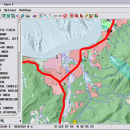
... tool that allows you to analyze and modify GIS images. It is a professional application that can handle desktop cartography, electronic atlas preparation and spatial database management. ...

Author MicroImages, Inc.
License Freeware
Price FREE
Released 2024-04-04
Downloads 720
Filesize 121.00 MB
Requirements
Installation Instal And Uninstall
Keywords GIS data analysis, analyze geodetic data, edit GIS dataset, GIS, dataset, editor, analysis
Users' rating
(34 rating)
TNTmipsCADWindows XP, Windows Vista, Windows Vista x64, Windows 7, Windows 7 x64, Windows 8, Windows 8 x64, Windows 10, Windows 10 x64, Windows 11
TNTmips gis maps - Download Notice

Using TNTmips Free Download crack, warez, password, serial numbers, torrent, keygen, registration codes, key generators is illegal and your business could subject you to lawsuits and leave your operating systems without patches. We do not host any torrent files or links of TNTmips on rapidshare.com, depositfiles.com, megaupload.com etc. All TNTmips download links are direct TNTmips full download from publisher site or their selected mirrors.
Avoid: gis maps oem software, old version, warez, serial, torrent, TNTmips keygen, crack.
Consider: TNTmips full version, gis maps full download, premium download, licensed copy.

TNTmips gis maps - The Latest User Reviews

Most popular CAD downloads

Metes and Bounds

6.2.1 download

... Bounds is a software that can create plot maps, perform calculations in square feets, acres, hectares, perimeter ... for integration with other mapping software such as GIS software. ยท Custom X,Y points. Use custom ...

JMARS

3.1.5 download

... roughness data with thermal inertia data. * Contour maps may be created. * Groups of layers can ... THEMIS, Viking, and CTX; topography from MOLA; compositional maps from TES and GRS/HEND; albedo and thermal inertia ...

JMARS for Windows

3.1.5 download

... roughness data with thermal inertia data. * Contour maps may be created. * Groups of layers can ... THEMIS, Viking, and CTX; topography from MOLA; compositional maps from TES and GRS/HEND; albedo and thermal inertia ...

ArcReader

10.5.0 B6491 download

... that allows users to view, explore, and print maps and globes. Anyone with ArcReader can view high-quality interactive maps authored by a high-level ArcGIS for Desktop product ... of details that can be contained in these maps through the multiple layers supported by PMF documents ...

TNTmips

20240404 download

... formats without importing. Overlay your geodata on Bing Maps imagery and maps or on geodata layers published on the Internet ... Spatial, DGN, TAB, DXF, DWG ... Full-featured GIS that integrates imagery along with geometric data including ...

CARIS Easy View

4.2.13 download

... support for multiple types of files, as various GIS applications save maps and models to a wide array of formats. ...

Elshayal Smart

23.02 download

Elshayal Smart is the first Arabian GIS software that is completely developed by Arabian developers ... independent of any commercial software package. Download Maps from Google Earth, and Trace & save GPS ...

MapInfo Professional

17.0.4 download

MapInfo Professional is a full-featured computer mapping and GIS analysis utility that provides a rich set of ... data and creating detailed, yet intelligible graphical representations, maps and reports. Location adds complexity to many decisions, ...

TNTmips for Mac OS X

20240111 download

... formats without importing. Overlay your geodata on Bing Maps imagery and maps or on geodata layers published on the Internet ... Oracle Spatial, DGN, TAB, DXF, DWG. Full-featured GIS that integrates imagery along with geometric data including ...