TopoLT 15.2

TopoLT is an application offering tools for 2D and 3D aplications and functionalities useful for all those who design topographical or cadastral plans in digital format, who develop 3D terrain models and contours, fill and cut volumes calculation, raster image georeferencing and automatic printing. 3D model of the terrain and contour lines can be generated, volumes can be calculated without any restrictions. ...

Author CADWARE Engineering
License Trialware
Price $600.00
Released 2023-10-16
Downloads 690
Filesize 67.80 MB
Requirements
Installation Instal And Uninstall
Keywords topographical plan, cadastral plan, terrain model, topography, cadaster, terrain
Users' rating
(54 rating)
TopoLTCADWindows XP, Windows Vista, Windows Vista x64, Windows 7, Windows 7 x64, Windows 8, Windows 8 x64, Windows 10, Windows 10 x64, Windows 11
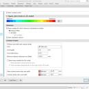
TopoLT view 3d surface - Download Notice

Using TopoLT Free Download crack, warez, password, serial numbers, torrent, keygen, registration codes, key generators is illegal and your business could subject you to lawsuits and leave your operating systems without patches. We do not host any torrent files or links of TopoLT on rapidshare.com, depositfiles.com, megaupload.com etc. All TopoLT download links are direct TopoLT full download from publisher site or their selected mirrors.
Avoid: view 3d surface oem software, old version, warez, serial, torrent, TopoLT keygen, crack.
Consider: TopoLT full version, view 3d surface full download, premium download, licensed copy.

TopoLT view 3d surface - The Latest User Reviews

Most popular CAD downloads

MountainsMap Scanning Topography

6.2.6266 download

... Topography is a professional application designed to perform surface analysis for 3D surface profilometers. With MountainsMap Scanning Topography, users will ... metrology data. It features an extensive set of surface texture parameters. FEATURES: MountainsMap® Scanning Topography ...

TriSpace

2021.24.3.652 download

... plans, contoured elevation plans, dynamic sections, three dimensional views, distances or areas and volume calculations. Thus this ... plans can be associated on each level; 3D view of individual surveys or complete levels; Choice of ...

TopoLT

15.2 download

... restrictions (the volume obtained by intersecting a 3D surface with a plane or the volume between two 3D surfaces of any grid form or triangles); · 3D ... numbered sheets can be created in order to view or print plan by plan when there are ...

VEGA ZZ

3.2.3.28 download

... hardware anti-aliasing, material management, 3D backgrounds. Stereo view (shutter or anaglyphic glasses). 10 bit output for each color channel for a smoother view (230 = 1.073.741.824 vs. 224 = 16.777.216 colors). ...

TNTmips

20240404 download

... any type of geospatial data including imagery, terrain surfaces, and map data with associated database attributes. It provides all the tools you need to view, create, edit, georeference, interpret, and publish any type ...

CARIS Easy View

4.2.13 download

CARIS Easy View is a simple application that enables you to view spatial data imported from numerous types of files. ... layers, change their order and adjust object parameters. View your spatial data using the free CARIS viewer. ...

ShapeBook with 2D3DSteel

4.4.2009 download

... calculator that creates steel material lists with weight, surface area, and price extensions. ShapeBook also includes a ... coatings. The Calculator Material List extends the weight, surface area, and pricing (price per pound or kilogram) ...

5 award

CADbro

2020 download

CADbro is a 3D CAD viewer that helps with your collaboration on engineering data. ... management, production planning, manufacturing, technical documentation. Open and view file created by NX, Catia, Creo ProE and ...

3D FastView

1.0 download

... CAD model using various methods including generating exploded views according to a different axis, creating perspective views with snapshots, etc. * Annotate and Measure 3D ... measurement by using traditional 2D markup tools, applying surface and 3D annotation labels, calculating surface areas, volumes, ...

TNTmips for Mac OS X

20240111 download

... any type of geospatial data including imagery, terrain surfaces, and map data with associated database attributes. It provides all the tools you need to view, create, edit, georeference, interpret, and publish any type ...